Colle San Magno geodata
Colle San Magno (Latium) is a seat of a third-order administrative division; located in Italy in Europe/Rome (GMT+2) time zone. With population of 513 people, there are 9792 cities with bigger population in this country. Compared to other cities in Italy, 74.4% of cities are located further ↑North; 75.5% of cities are located further ←West and 80.8% of cities have lower elevation than Colle San Magno. Note1
Administrative division(s):
- Level 1: Latium
- Level 2: Provincia di Frosinone
- Level 3: Colle San Magno


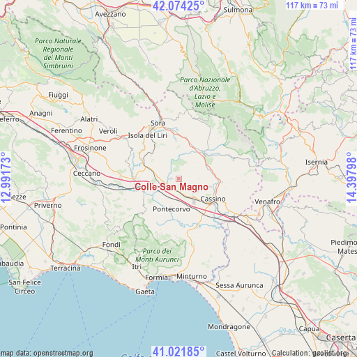
Colle San Magno GPS coordinates[2]
41° 33' 0.684" North, 13° 41' 41.46" East
| Map corner | latitude | longitude |
|---|---|---|
| Upper-left | 42.07425°, | 12.99173° |
| Center: | 41.55019°, | 13.69485° |
| Lower-right: | 41.02185°, | 14.39798° |
| Map W x H: | 117×117 km | = 72.7×72.7mi |
| max Lat: | 47.04031° ⇑74.4% North |
| Colle San Magno: | 41.55019° |
| min Lat: | ⇓25.6% South 35.50142° |
| min Long | Colle San Magno | max Long |
| 6.69888° | 13.69485° | 18.48682° |
| W 75.5%⇐ | ⇒24.5% E |
Elevation
Elevation of Colle San Magno is 536 m = 1759 ft, and this is 229.3 m = 752 ft above average elevation for this country.
| Max E: |
2085 m = 6841 ft | 19.2% |
| Colle San Magno | 536 m 1759 ft | |
| Avg. | 306.7 m = 1006 ft | |
Min E: |
-4 m = -13 ft | 80.8% |
See also: Italy elevation on elevation.city.
Geographical zone
Colle San Magno is located in North temperate zone (between Tropic of Cancer and the Arctic Circle). Distance of this Northern Tropic circle is 2014 km =1251.4 mi to South.| Distance of | km | miles | from Colle San Magno |
|---|---|---|---|
| North Pole | 5387.1 | 3347.4 | to North |
| Arctic Circle | 2781.2 | 1728.2 | to North |
| Tropic Cancer | 2014 | 1251.4 | to South |
| Equator | 4619.9 | 2870.7 | to South |


Nearby cities:
15 places around Colle San Magno: (largest is in red/bold)
• Aquino
6.3 km =3.9 mi,  172°
172°
• Arce
9.6 km =6 mi,  288°
288°
• Casalattico
8.4 km =5.2 mi,  17°
17°
• Casalvieri
9.4 km =5.8 mi,  9°
9°
• Castrocielo
2.5 km =1.6 mi,  178°
178°
• Coldragone
7.6 km =4.7 mi,  273°
273°
• Piedimonte San Germano
7.4 km =4.6 mi,  141°
141°
• Piedimonte San Germano Alta
6.8 km =4.2 mi, 138°
• Rocca d'Arce
10 km =6.2 mi, 294°
• Roccasecca
2.3 km =1.4 mi, 273°
• Roccasecca Stazione
4.2 km =2.6 mi,  243°
243°
• Santopadre
7.6 km =4.7 mi,  319°
319°
• Terelle
7 km =4.3 mi,  88°
88°
• Villa Felice
6.4 km =4 mi, 274°
• Villa Santa Lucia
7.5 km =4.7 mi,  124°
124°
Sources, notices
• [Note1] Compared only with cities in Italy existing in our database
• [Src1] Map data: © OpenStreetMap contributors (CC-BY-SA)
• [Src2] Other city data from geonames.org with taken over terms of usage.
• [Src3] Geographical zone / Annual Mean Temperature by Robert A. Rohde @ Wikipedia
