Civitella Messer Raimondo geodata
Civitella Messer Raimondo (Abruzzo) is a seat of a third-order administrative division; located in Italy in Europe/Rome (GMT+2) time zone. With population of 257 people, there are 10860 cities with bigger population in this country. Compared to other cities in Italy, 69.6% of cities are located further ↑North; 80% of cities are located further ←West and 84.3% of cities have lower elevation than Civitella Messer Raimondo. Note1
Administrative division(s):
- Level 1: Abruzzo
- Level 2: Provincia di Chieti
- Level 3: Civitella Messer Raimondo
Current local time in Civitella Messer Raimondo:
11:46 PM, WednesdayDifference from your time zone: hours


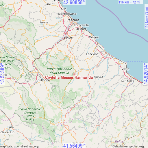
Civitella Messer Raimondo GPS coordinates[2]
42° 5' 20.148" North, 14° 13' 1.236" East
| Map corner | latitude | longitude |
|---|---|---|
| Upper-left | 42.60858°, | 13.51389° |
| Center: | 42.08893°, | 14.21701° |
| Lower-right: | 41.56499°, | 14.92014° |
| Map W x H: | 116×116 km | = 72.1×72.1mi |
| max Lat: | 47.04031° ⇑69.6% North |
| Civitella Messer Raimondo: | 42.08893° |
| min Lat: | ⇓30.4% South 35.50142° |
| min Long | Civitella Messe | max Long |
| 6.69888° | 14.21701° | 18.48682° |
| W 80%⇐ | ⇒20% E |
Elevation
Elevation of Civitella Messer Raimondo is 597 m = 1959 ft, and this is 290.3 m = 952 ft above average elevation for this country.
| Max E: |
2085 m = 6841 ft | 15.7% |
| Civitella Messer Raimondo | 597 m 1959 ft | |
| Avg. | 306.7 m = 1006 ft | |
Min E: |
-4 m = -13 ft | 84.3% |
See also: Italy elevation on elevation.city.
Geographical zone
Civitella Messer Raimondo is located in North temperate zone (between Tropic of Cancer and the Arctic Circle). Distance of this Northern Tropic circle is 2073.9 km =1288.7 mi to South.| Distance of | km | miles | from Civitella Messer Raimondo |
|---|---|---|---|
| North Pole | 5327.2 | 3310.2 | to North |
| Arctic Circle | 2721.3 | 1690.9 | to North |
| Tropic Cancer | 2073.9 | 1288.7 | to South |
| Equator | 4679.9 | 2908 | to South |


Nearby cities:
15 places around Civitella Messer Raimondo: (largest is in red/bold)
• Altino
9.6 km =6 mi,  82°
82°
• Casoli
6.6 km =4.1 mi,  65°
65°
• Colledimacine
9.6 km =6 mi,  188°
188°
• Fara San Martino
0.8 km =0.5 mi,  300°
300°
• Gessopalena
6 km =3.7 mi,  128°
128°
• Guardiagrele
11.7 km =7.3 mi,  0°
0°
• Lama dei Peligni
5.8 km =3.6 mi,  205°
205°
• Lettopalena
10.8 km =6.7 mi, 207°
• Palombaro
4 km =2.5 mi,  15°
15°
• Pennapiedimonte
7.6 km =4.7 mi,  345°
345°
• Roccascalegna
8.1 km =5 mi,  111°
111°
• Sant'Eusanio del Sangro
12.8 km =8 mi,  45°
45°
• Selva
10.9 km =6.8 mi, 74°
• Taranta Peligna
8.5 km =5.3 mi, 206°
• Torricella Peligna
8 km =5 mi,  154°
154°
Sources, notices
• [Note1] Compared only with cities in Italy existing in our database
• [Src1] Map data: © OpenStreetMap contributors (CC-BY-SA)
• [Src2] Other city data from geonames.org with taken over terms of usage.
• [Src3] Geographical zone / Annual Mean Temperature by Robert A. Rohde @ Wikipedia
