Selva geodata
Selva (Abruzzo) is a populated place; located in Italy in Europe/Rome (GMT+2) time zone. With population of 1,597 people, there are 4916 cities with bigger population in this country. Compared to other cities in Italy, 69.3% of cities are located further ↑North; 81.3% of cities are located further ←West and 64.9% of cities have higher elevation than Selva. Note1


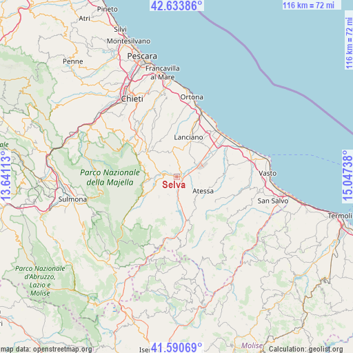
Selva GPS coordinates[2]
42° 6' 51.912" North, 14° 20' 39.3" East
| Map corner | latitude | longitude |
|---|---|---|
| Upper-left | 42.63386°, | 13.64113° |
| Center: | 42.11442°, | 14.34425° |
| Lower-right: | 41.59069°, | 15.04738° |
| Map W x H: | 116×116 km | = 72.1×72.1mi |
| max Lat: | 47.04031° ⇑69.3% North |
| Selva: | 42.11442° |
| min Lat: | ⇓30.7% South 35.50142° |
| min Long | Selva | max Long |
| 6.69888° | 14.34425° | 18.48682° |
| W 81.3%⇐ | ⇒18.7% E |
Elevation
Elevation of Selva is 128 m = 420 ft, and this is 178.7 m = 586 ft below average elevation for this country.
| Max E: |
2085 m = 6841 ft | 64.9% |
| Avg. | 306.7 m = 1006 ft | |
| Selva | 128 m = 420 ft | |
Min E: |
-4 m = -13 ft | 35.1% |
See also: Italy elevation on elevation.city.
Geographical zone
Selva is located in North temperate zone (between Tropic of Cancer and the Arctic Circle). Distance of this Northern Tropic circle is 2076.8 km =1290.5 mi to South.| Distance of | km | miles | from Selva |
|---|---|---|---|
| North Pole | 5324.4 | 3308.4 | to North |
| Arctic Circle | 2718.5 | 1689.2 | to North |
| Tropic Cancer | 2076.8 | 1290.5 | to South |
| Equator | 4682.7 | 2909.7 | to South |


Nearby cities:
15 places around Selva: (largest is in red/bold)
• Altino
1.9 km =1.2 mi,  210°
210°
• Archi
4.1 km =2.5 mi,  128°
128°
• Atessa
10.1 km =6.3 mi,  119°
119°
• Bomba
9.2 km =5.7 mi,  168°
168°
• Casoli
4.5 km =2.8 mi,  269°
269°
• Castel Frentano
9.4 km =5.8 mi,  6°
6°
• Gessopalena
8.8 km =5.5 mi,  221°
221°
• Monte Marcone
7.3 km =4.5 mi,  82°
82°
• Palombaro
9.5 km =5.9 mi,  275°
275°
• Perano
4.4 km =2.7 mi,  104°
104°
• Piane d'Archi-Quadroni
2.5 km =1.6 mi, 119°
• Piazzano-Piana la Fara
5.7 km =3.5 mi,  74°
74°
• Quadroni-Fontolfi-Impicciaturo-Maligni
2.7 km =1.7 mi, 102°
• Roccascalegna
6.5 km =4 mi, 207°
• Sant'Eusanio del Sangro
6.2 km =3.9 mi,  347°
347°
Sources, notices
• [Note1] Compared only with cities in Italy existing in our database
• [Src1] Map data: © OpenStreetMap contributors (CC-BY-SA)
• [Src2] Other city data from geonames.org with taken over terms of usage.
• [Src3] Geographical zone / Annual Mean Temperature by Robert A. Rohde @ Wikipedia
