Cingia de' Botti geodata
Cingia de' Botti (Lombardy) is a seat of a third-order administrative division; located in Italy in Europe/Rome (GMT+2) time zone. With population of 799 people, there are 7649 cities with bigger population in this country. Compared to other cities in Italy, 62.1% of cities are located further ↓South; 65.3% of cities are located further →East and 85.2% of cities have higher elevation than Cingia de' Botti. Note1
Administrative division(s):
- Level 1: Lombardy
- Level 2: Provincia di Cremona
- Level 3: Cingia de' Botti


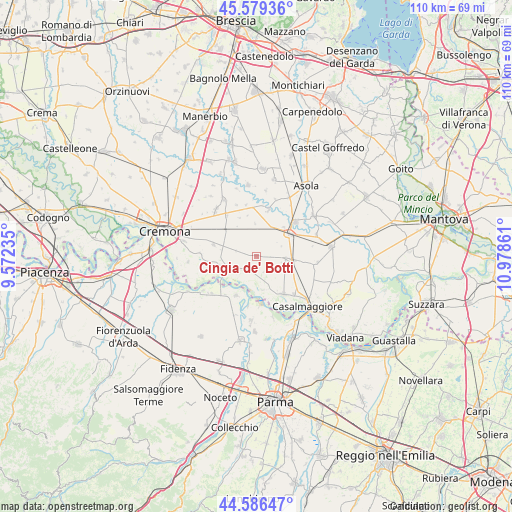
Cingia de' Botti GPS coordinates[2]
45° 5' 6.252" North, 10° 16' 31.728" East
| Map corner | latitude | longitude |
|---|---|---|
| Upper-left | 45.57936°, | 9.57235° |
| Center: | 45.08507°, | 10.27548° |
| Lower-right: | 44.58647°, | 10.97861° |
| Map W x H: | 110.4×110.4 km | = 68.6×68.6mi |
| max Lat: | 47.04031° ⇑37.9% North |
| Cingia de' Botti: | 45.08507° |
| min Lat: | ⇓62.1% South 35.50142° |
| min Long | Cingia de' Bott | max Long |
| 6.69888° | 10.27548° | 18.48682° |
| W 34.7%⇐ | ⇒65.3% E |
Elevation
Elevation of Cingia de' Botti is 30 m = 98 ft, and this is 276.7 m = 908 ft below average elevation for this country.
| Max E: |
2085 m = 6841 ft | 85.2% |
| Avg. | 306.7 m = 1006 ft | |
| Cingia de' Botti | 30 m = 98 ft | |
Min E: |
-4 m = -13 ft | 14.8% |
See also: Italy elevation on elevation.city.
Geographical zone
Cingia de' Botti is located in North temperate zone (between Tropic of Cancer and the Arctic Circle). Distance of this North polar circle is 2388.2 km =1484 mi to North.| Distance of | km | miles | from Cingia de' Botti |
|---|---|---|---|
| North Pole | 4994.1 | 3103.2 | to North |
| Arctic Circle | 2388.2 | 1484 | to North |
| Tropic Cancer | 2407.1 | 1495.7 | to South |
| Equator | 5013 | 3114.9 | to South |


Nearby cities:
15 places around Cingia de' Botti: (largest is in red/bold)
• Ca' d'Andrea
3.8 km =2.4 mi,  2°
2°
• Cella Dati
4.4 km =2.7 mi,  284°
284°
• Derovere
3.5 km =2.2 mi,  322°
322°
• Drizzona
8.6 km =5.3 mi,  42°
42°
• Motta Baluffi
3.5 km =2.2 mi,  202°
202°
• Piadena
8.9 km =5.5 mi,  57°
57°
• Pieve San Giacomo
8.6 km =5.3 mi,  307°
307°
• San Daniele Po
8 km =5 mi,  255°
255°
• San Giovanni in Croce
7.8 km =4.8 mi,  99°
99°
• San Martino del Lago
3.5 km =2.2 mi,  114°
114°
• Scandolara Ravara
4.1 km =2.5 mi,  149°
149°
• Solarolo Rainerio
6.4 km =4 mi,  93°
93°
• Torre de' Picenardi
6.5 km =4 mi,  8°
8°
• Torricella del Pizzo
7.4 km =4.6 mi,  168°
168°
• Voltido
5.4 km =3.4 mi, 56°
Sources, notices
• [Note1] Compared only with cities in Italy existing in our database
• [Src1] Map data: © OpenStreetMap contributors (CC-BY-SA)
• [Src2] Other city data from geonames.org with taken over terms of usage.
• [Src3] Geographical zone / Annual Mean Temperature by Robert A. Rohde @ Wikipedia
