Voltido geodata
Voltido (Lombardy) is a seat of a third-order administrative division; located in Italy in Europe/Rome (GMT+2) time zone. With population of 176 people, there are 11208 cities with bigger population in this country. Compared to other cities in Italy, 62.7% of cities are located further ↓South; 64.7% of cities are located further →East and 84.1% of cities have higher elevation than Voltido. Note1


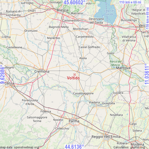
Voltido GPS coordinates[2]
45° 6' 43.092" North, 10° 19' 58.728" East
| Map corner | latitude | longitude |
|---|---|---|
| Upper-left | 45.60602°, | 9.62986° |
| Center: | 45.11197°, | 10.33298° |
| Lower-right: | 44.6136°, | 11.03611° |
| Map W x H: | 110.3×110.3 km | = 68.5×68.5mi |
| max Lat: | 47.04031° ⇑37.3% North |
| Voltido: | 45.11197° |
| min Lat: | ⇓62.7% South 35.50142° |
| min Long | Voltido | max Long |
| 6.69888° | 10.33298° | 18.48682° |
| W 35.3%⇐ | ⇒64.7% E |
Elevation
Elevation of Voltido is 34 m = 112 ft, and this is 272.7 m = 895 ft below average elevation for this country.
| Max E: |
2085 m = 6841 ft | 84.1% |
| Avg. | 306.7 m = 1006 ft | |
| Voltido | 34 m = 112 ft | |
Min E: |
-4 m = -13 ft | 15.9% |
See also: Italy elevation on elevation.city.
Geographical zone
Voltido is located in North temperate zone (between Tropic of Cancer and the Arctic Circle). Distance of this North polar circle is 2385.2 km =1482.1 mi to North.| Distance of | km | miles | from Voltido |
|---|---|---|---|
| North Pole | 4991.1 | 3101.3 | to North |
| Arctic Circle | 2385.2 | 1482.1 | to North |
| Tropic Cancer | 2410.1 | 1497.6 | to South |
| Equator | 5016 | 3116.8 | to South |


Nearby cities:
15 places around Voltido: (largest is in red/bold)
• Ca' d'Andrea
4.4 km =2.7 mi,  280°
280°
• Calvatone
8.6 km =5.3 mi,  78°
78°
• Canneto sull'Oglio
5.9 km =3.7 mi,  41°
41°
• Casteldidone
7.3 km =4.5 mi,  128°
128°
• Cingia de' Botti
5.4 km =3.4 mi,  236°
236°
• Derovere
6.7 km =4.2 mi,  268°
268°
• Drizzona
3.6 km =2.2 mi,  22°
22°
• Isola Dovarese
7 km =4.3 mi,  344°
344°
• Piadena
3.5 km =2.2 mi,  58°
58°
• San Giovanni in Croce
5.3 km =3.3 mi,  143°
143°
• San Martino del Lago
4.6 km =2.9 mi,  197°
197°
• Scandolara Ravara
7 km =4.3 mi, 200°
• Solarolo Rainerio
3.9 km =2.4 mi,  150°
150°
• Tornata
7.7 km =4.8 mi,  96°
96°
• Torre de' Picenardi
4.9 km =3 mi,  314°
314°
Sources, notices
• [Note1] Compared only with cities in Italy existing in our database
• [Src1] Map data: © OpenStreetMap contributors (CC-BY-SA)
• [Src2] Other city data from geonames.org with taken over terms of usage.
• [Src3] Geographical zone / Annual Mean Temperature by Robert A. Rohde @ Wikipedia
