Ca' d'Andrea geodata
Ca' d'Andrea (Lombardy) is a seat of a third-order administrative division; located in Italy in Europe/Rome (GMT+2) time zone. With population of 216 people, there are 11051 cities with bigger population in this country. Compared to other cities in Italy, 63% of cities are located further ↓South; 65.2% of cities are located further →East and 84.1% of cities have higher elevation than Ca' d'Andrea. Note1
Administrative division(s):
- Level 1: Lombardy
- Level 2: Provincia di Cremona
- Level 3: Torre de' Picenardi


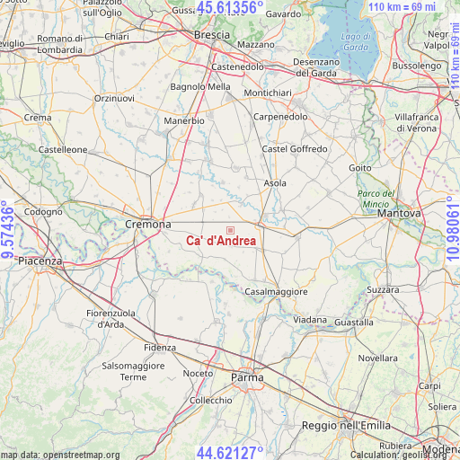
Ca' d'Andrea GPS coordinates[2]
45° 7' 10.452" North, 10° 16' 38.928" East
| Map corner | latitude | longitude |
|---|---|---|
| Upper-left | 45.61356°, | 9.57436° |
| Center: | 45.11957°, | 10.27748° |
| Lower-right: | 44.62127°, | 10.98061° |
| Map W x H: | 110.3×110.3 km | = 68.5×68.5mi |
| max Lat: | 47.04031° ⇑37% North |
| Ca' d'Andrea: | 45.11957° |
| min Lat: | ⇓63% South 35.50142° |
| min Long | Ca' d'Andrea | max Long |
| 6.69888° | 10.27748° | 18.48682° |
| W 34.8%⇐ | ⇒65.2% E |
Elevation
Elevation of Ca' d'Andrea is 34 m = 112 ft, and this is 272.7 m = 895 ft below average elevation for this country.
| Max E: |
2085 m = 6841 ft | 84.1% |
| Avg. | 306.7 m = 1006 ft | |
| Ca' d'Andrea | 34 m = 112 ft | |
Min E: |
-4 m = -13 ft | 15.9% |
See also: Italy elevation on elevation.city.
Geographical zone
Ca' d'Andrea is located in North temperate zone (between Tropic of Cancer and the Arctic Circle). Distance of this North polar circle is 2384.3 km =1481.5 mi to North.| Distance of | km | miles | from Ca' d'Andrea |
|---|---|---|---|
| North Pole | 4990.2 | 3100.8 | to North |
| Arctic Circle | 2384.3 | 1481.5 | to North |
| Tropic Cancer | 2410.9 | 1498.1 | to South |
| Equator | 5016.8 | 3117.3 | to South |


Nearby cities:
15 places around Ca' d'Andrea: (largest is in red/bold)
• Cappella de' Picenardi
5.7 km =3.5 mi,  319°
319°
• Cella Dati
5.2 km =3.2 mi,  238°
238°
• Cingia de' Botti
3.8 km =2.4 mi,  182°
182°
• Derovere
2.5 km =1.6 mi,  245°
245°
• Drizzona
6.2 km =3.9 mi,  66°
66°
• Isola Dovarese
6.4 km =4 mi,  22°
22°
• Motta Baluffi
7.3 km =4.5 mi,  191°
191°
• Pessina Cremonese
7.6 km =4.7 mi,  342°
342°
• Piadena
7.4 km =4.6 mi,  82°
82°
• Pieve San Giacomo
7.2 km =4.5 mi,  281°
281°
• San Martino del Lago
6 km =3.7 mi,  150°
150°
• Scandolara Ravara
7.6 km =4.7 mi,  165°
165°
• Solarolo Rainerio
7.6 km =4.7 mi,  124°
124°
• Torre de' Picenardi
2.8 km =1.7 mi, 17°
• Voltido
4.4 km =2.7 mi,  100°
100°
Sources, notices
• [Note1] Compared only with cities in Italy existing in our database
• [Src1] Map data: © OpenStreetMap contributors (CC-BY-SA)
• [Src2] Other city data from geonames.org with taken over terms of usage.
• [Src3] Geographical zone / Annual Mean Temperature by Robert A. Rohde @ Wikipedia
