Casto geodata
Casto (Lombardy) is a seat of a third-order administrative division; located in Italy in Europe/Rome (GMT+2) time zone. With population of 732 people, there are 8069 cities with bigger population in this country. Compared to other cities in Italy, 81% of cities are located further ↓South; 64.8% of cities are located further →East and 73% of cities have lower elevation than Casto. Note1


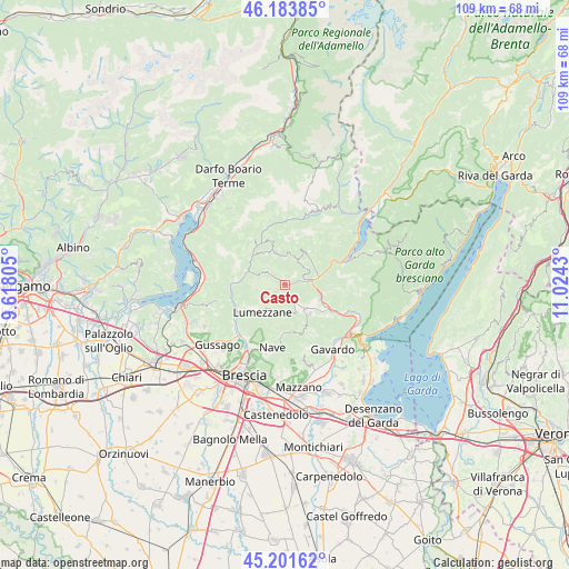
Casto GPS coordinates[2]
45° 41' 41.604" North, 10° 19' 16.212" East
| Map corner | latitude | longitude |
|---|---|---|
| Upper-left | 46.18385°, | 9.61805° |
| Center: | 45.69489°, | 10.32117° |
| Lower-right: | 45.20162°, | 11.0243° |
| Map W x H: | 109.2×109.2 km | = 67.9×67.9mi |
| max Lat: | 47.04031° ⇑19% North |
| Casto: | 45.69489° |
| min Lat: | ⇓81% South 35.50142° |
| min Long | Casto | max Long |
| 6.69888° | 10.32117° | 18.48682° |
| W 35.2%⇐ | ⇒64.8% E |
Elevation
Elevation of Casto is 425 m = 1394 ft, and this is 118.3 m = 388 ft above average elevation for this country.
| Max E: |
2085 m = 6841 ft | 27% |
| Casto | 425 m 1394 ft | |
| Avg. | 306.7 m = 1006 ft | |
Min E: |
-4 m = -13 ft | 73% |
See also: Italy elevation on elevation.city.
Geographical zone
Casto is located in North temperate zone (between Tropic of Cancer and the Arctic Circle). Distance of this North polar circle is 2320.4 km =1441.8 mi to North.| Distance of | km | miles | from Casto |
|---|---|---|---|
| North Pole | 4926.3 | 3061.1 | to North |
| Arctic Circle | 2320.4 | 1441.8 | to North |
| Tropic Cancer | 2474.9 | 1537.8 | to South |
| Equator | 5080.8 | 3157.1 | to South |


Nearby cities:
15 places around Casto: (largest is in red/bold)
• Agnosine
5.6 km =3.5 mi,  154°
154°
• Barghe
7 km =4.3 mi,  105°
105°
• Bione
2.8 km =1.7 mi, 150°
• Briale
1 km =0.6 mi,  341°
341°
• Gazzane
6.1 km =3.8 mi,  132°
132°
• Lodrino
4.4 km =2.7 mi,  309°
309°
• Lumezzane
6.8 km =4.2 mi,  219°
219°
• Mura
2.6 km =1.6 mi,  38°
38°
• Pertica Alta
5.6 km =3.5 mi,  18°
18°
• Preseglie
6.6 km =4.1 mi,  116°
116°
• San Faustino
3.6 km =2.2 mi, 150°
• San Sebastiano
6.9 km =4.3 mi,  226°
226°
• Sottocastello
6.5 km =4 mi, 118°
• Vestone
6 km =3.7 mi,  76°
76°
• Villa
4.2 km =2.6 mi, 308°
Sources, notices
• [Note1] Compared only with cities in Italy existing in our database
• [Src1] Map data: © OpenStreetMap contributors (CC-BY-SA)
• [Src2] Other city data from geonames.org with taken over terms of usage.
• [Src3] Geographical zone / Annual Mean Temperature by Robert A. Rohde @ Wikipedia
