Castelfiorentino geodata
Castelfiorentino (Tuscany) is a seat of a third-order administrative division; located in Italy in Europe/Rome (GMT+2) time zone. With population of 12,656 people, there are 730 cities with bigger population in this country. Compared to other cities in Italy, 58.9% of cities are located further ↑North; 57.7% of cities are located further →East and 78.8% of cities have higher elevation than Castelfiorentino. Note1
Administrative division(s):
- Level 1: Tuscany
- Level 2: Province of Florence
- Level 3: Castelfiorentino


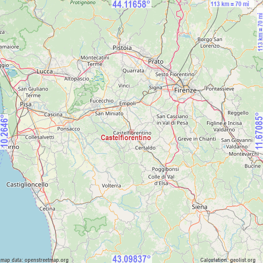
Castelfiorentino GPS coordinates[2]
43° 36' 34.668" North, 10° 58' 3.792" East
| Map corner | latitude | longitude |
|---|---|---|
| Upper-left | 44.11658°, | 10.2646° |
| Center: | 43.60963°, | 10.96772° |
| Lower-right: | 43.09837°, | 11.67085° |
| Map W x H: | 113.2×113.2 km | = 70.3×70.3mi |
| max Lat: | 47.04031° ⇑58.9% North |
| Castelfiorentino: | 43.60963° |
| min Lat: | ⇓41.1% South 35.50142° |
| min Long | Castelfiorentin | max Long |
| 6.69888° | 10.96772° | 18.48682° |
| W 42.3%⇐ | ⇒57.7% E |
Elevation
Elevation of Castelfiorentino is 55 m = 180 ft, and this is 251.7 m = 826 ft below average elevation for this country.
| Max E: |
2085 m = 6841 ft | 78.8% |
| Avg. | 306.7 m = 1006 ft | |
| Castelfiorentino | 55 m = 180 ft | |
Min E: |
-4 m = -13 ft | 21.2% |
See also: Italy elevation on elevation.city.
Geographical zone
Castelfiorentino is located in North temperate zone (between Tropic of Cancer and the Arctic Circle). Distance of this Northern Tropic circle is 2243 km =1393.7 mi to South.| Distance of | km | miles | from Castelfiorentino |
|---|---|---|---|
| North Pole | 5158.1 | 3205.1 | to North |
| Arctic Circle | 2552.2 | 1585.9 | to North |
| Tropic Cancer | 2243 | 1393.7 | to South |
| Equator | 4848.9 | 3013 | to South |


Nearby cities:
15 places around Castelfiorentino: (largest is in red/bold)
• Baccaiano
11.1 km =6.9 mi,  56°
56°
• Badia A Elmi
9.5 km =5.9 mi,  146°
146°
• Badia a Cerreto
8.5 km =5.3 mi, 146°
• Cambiano
2.7 km =1.7 mi,  347°
347°
• Case Nuove
3.3 km =2.1 mi,  182°
182°
• Castelnuovo d'Elsa
3.7 km =2.3 mi,  319°
319°
• Certaldo
9 km =5.6 mi,  140°
140°
• Dogana
1.5 km =0.9 mi,  296°
296°
• Empoli
12.2 km =7.6 mi, 352°
• Gambassi Terme
8.3 km =5.2 mi,  188°
188°
• Montaione
7.8 km =4.8 mi,  213°
213°
• Monterappoli
8 km =5 mi, 345°
• Montespertoli
9.3 km =5.8 mi,  66°
66°
• Ponte A Elsa
10.7 km =6.6 mi,  325°
325°
• Pozzale-Case Nuove
9.6 km =6 mi, 354°
Sources, notices
• [Note1] Compared only with cities in Italy existing in our database
• [Src1] Map data: © OpenStreetMap contributors (CC-BY-SA)
• [Src2] Other city data from geonames.org with taken over terms of usage.
• [Src3] Geographical zone / Annual Mean Temperature by Robert A. Rohde @ Wikipedia
