Casacalenda geodata
Casacalenda (Molise) is a seat of a third-order administrative division; located in Italy in Europe/Rome (GMT+2) time zone. With population of 2,041 people, there are 4085 cities with bigger population in this country. Compared to other cities in Italy, 72.5% of cities are located further ↑North; 85.9% of cities are located further ←West and 85.4% of cities have lower elevation than Casacalenda. Note1


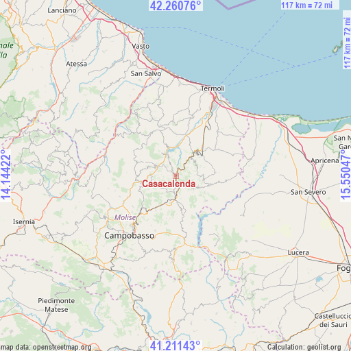
Casacalenda GPS coordinates[2]
41° 44' 17.664" North, 14° 50' 50.424" East
| Map corner | latitude | longitude |
|---|---|---|
| Upper-left | 42.26076°, | 14.14422° |
| Center: | 41.73824°, | 14.84734° |
| Lower-right: | 41.21143°, | 15.55047° |
| Map W x H: | 116.7×116.7 km | = 72.5×72.5mi |
| max Lat: | 47.04031° ⇑72.5% North |
| Casacalenda: | 41.73824° |
| min Lat: | ⇓27.5% South 35.50142° |
| min Long | Casacalenda | max Long |
| 6.69888° | 14.84734° | 18.48682° |
| W 85.9%⇐ | ⇒14.1% E |
Elevation
Elevation of Casacalenda is 621 m = 2037 ft, and this is 314.3 m = 1031 ft above average elevation for this country.
| Max E: |
2085 m = 6841 ft | 14.6% |
| Casacalenda | 621 m 2037 ft | |
| Avg. | 306.7 m = 1006 ft | |
Min E: |
-4 m = -13 ft | 85.4% |
See also: Italy elevation on elevation.city.
Geographical zone
Casacalenda is located in North temperate zone (between Tropic of Cancer and the Arctic Circle). Distance of this Northern Tropic circle is 2034.9 km =1264.4 mi to South.| Distance of | km | miles | from Casacalenda |
|---|---|---|---|
| North Pole | 5366.2 | 3334.4 | to North |
| Arctic Circle | 2760.3 | 1715.2 | to North |
| Tropic Cancer | 2034.9 | 1264.4 | to South |
| Equator | 4640.9 | 2883.7 | to South |


Nearby cities:
15 places around Casacalenda: (largest is in red/bold)
• Bonefro
8.1 km =5 mi,  117°
117°
• Castelbottaccio
11.8 km =7.3 mi,  278°
278°
• Castellino del Biferno
10.4 km =6.5 mi,  246°
246°
• Colletorto
13.1 km =8.1 mi,  130°
130°
• Guardialfiera
8.6 km =5.3 mi,  328°
328°
• Larino
9.4 km =5.8 mi,  38°
38°
• Lupara
9.8 km =6.1 mi,  285°
285°
• Montelongo
8.5 km =5.3 mi,  90°
90°
• Montorio Nei Frentani
7.5 km =4.7 mi,  72°
72°
• Morrone del Sannio
6.3 km =3.9 mi,  241°
241°
• Provvidenti
3 km =1.9 mi,  221°
221°
• Ripabottoni
6.3 km =3.9 mi,  210°
210°
• Rotello
13.2 km =8.2 mi, 85°
• San Giuliano di Puglia
11.1 km =6.9 mi, 120°
• Santa Croce di Magliano
12 km =7.5 mi,  103°
103°
Sources, notices
• [Note1] Compared only with cities in Italy existing in our database
• [Src1] Map data: © OpenStreetMap contributors (CC-BY-SA)
• [Src2] Other city data from geonames.org with taken over terms of usage.
• [Src3] Geographical zone / Annual Mean Temperature by Robert A. Rohde @ Wikipedia
