Carugate geodata
Carugate (Lombardy) is a seat of a third-order administrative division; located in Italy in Europe/Rome (GMT+2) time zone. With population of 13,421 people, there are 679 cities with bigger population in this country. Compared to other cities in Italy, 75.3% of cities are located further ↓South; 75.6% of cities are located further →East and 62% of cities have higher elevation than Carugate. Note1
Administrative division(s):
- Level 1: Lombardy
- Level 2: Città metropolitana di Milano
- Level 3: Carugate


Carugate GPS coordinates[2]
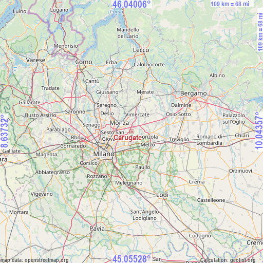
45° 32' 59.388" North, 9° 20' 25.584" East
| Map corner | latitude | longitude |
|---|---|---|
| Upper-left | 46.04006°, | 8.63732° |
| Center: | 45.54983°, | 9.34044° |
| Lower-right: | 45.05528°, | 10.04357° |
| Map W x H: | 109.5×109.5 km | = 68×68mi |
| max Lat: | 47.04031° ⇑24.7% North |
| Carugate: | 45.54983° |
| min Lat: | ⇓75.3% South 35.50142° |
| min Long | Carugate | max Long |
| 6.69888° | 9.34044° | 18.48682° |
| W 24.4%⇐ | ⇒75.6% E |
Elevation
Elevation of Carugate is 149 m = 489 ft, and this is 157.7 m = 517 ft below average elevation for this country.
| Max E: |
2085 m = 6841 ft | 62% |
| Avg. | 306.7 m = 1006 ft | |
| Carugate | 149 m = 489 ft | |
Min E: |
-4 m = -13 ft | 38% |
See also: Italy elevation on elevation.city.
Geographical zone
Carugate is located in North temperate zone (between Tropic of Cancer and the Arctic Circle). Distance of this North polar circle is 2336.5 km =1451.8 mi to North.| Distance of | km | miles | from Carugate |
|---|---|---|---|
| North Pole | 4942.4 | 3071.1 | to North |
| Arctic Circle | 2336.5 | 1451.8 | to North |
| Tropic Cancer | 2458.7 | 1527.8 | to South |
| Equator | 5064.7 | 3147.1 | to South |


Nearby cities:
15 places around Carugate: (largest is in red/bold)
• Agrate Brianza
2.8 km =1.7 mi,  12°
12°
• Brugherio
3.2 km =2 mi,  276°
276°
• Bussero
3 km =1.9 mi,  125°
125°
• Caponago
3.3 km =2.1 mi,  56°
56°
• Cassina de' Pecchi
4 km =2.5 mi,  157°
157°
• Cernusco sul Naviglio
2.8 km =1.7 mi,  192°
192°
• Cologno Monzese
5.3 km =3.3 mi,  245°
245°
• Concorezzo
4.3 km =2.7 mi,  353°
353°
• Gorgonzola
5.5 km =3.4 mi,  112°
112°
• Pessano Con Bornago
3.2 km =2 mi,  90°
90°
• Pioltello
5.4 km =3.4 mi, 188°
• Ronco
3 km =1.9 mi,  150°
150°
• Sant'Agata Martesana
4.6 km =2.9 mi, 132°
• Torrazza dei Mandelli
4.9 km =3 mi,  68°
68°
• Vimodrone
5.7 km =3.5 mi,  226°
226°
Sources, notices
• [Note1] Compared only with cities in Italy existing in our database
• [Src1] Map data: © OpenStreetMap contributors (CC-BY-SA)
• [Src2] Other city data from geonames.org with taken over terms of usage.
• [Src3] Geographical zone / Annual Mean Temperature by Robert A. Rohde @ Wikipedia
