Carpignano Sesia geodata
Carpignano Sesia (Piedmont) is a seat of a third-order administrative division; located in Italy in Europe/Rome (GMT+2) time zone. With population of 2,562 people, there are 3450 cities with bigger population in this country. Compared to other cities in Italy, 74.8% of cities are located further ↓South; 88.9% of cities are located further →East and 55.1% of cities have higher elevation than Carpignano Sesia. Note1
Administrative division(s):
- Level 1: Piedmont
- Level 2: Provincia di Novara
- Level 3: Carpignano Sesia


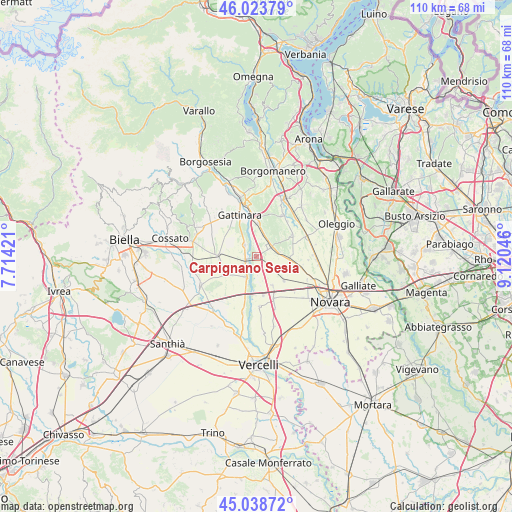
Carpignano Sesia GPS coordinates[2]
45° 32' 0.276" North, 8° 25' 2.424" East
| Map corner | latitude | longitude |
|---|---|---|
| Upper-left | 46.02379°, | 7.71421° |
| Center: | 45.53341°, | 8.41734° |
| Lower-right: | 45.03872°, | 9.12046° |
| Map W x H: | 109.5×109.5 km | = 68×68mi |
| max Lat: | 47.04031° ⇑25.2% North |
| Carpignano Sesia: | 45.53341° |
| min Lat: | ⇓74.8% South 35.50142° |
| min Long | Carpignano Sesi | max Long |
| 6.69888° | 8.41734° | 18.48682° |
| W 11.1%⇐ | ⇒88.9% E |
Elevation
Elevation of Carpignano Sesia is 202 m = 663 ft, and this is 104.7 m = 344 ft below average elevation for this country.
| Max E: |
2085 m = 6841 ft | 55.1% |
| Avg. | 306.7 m = 1006 ft | |
| Carpignano Sesia | 202 m = 663 ft | |
Min E: |
-4 m = -13 ft | 44.9% |
See also: Italy elevation on elevation.city.
Geographical zone
Carpignano Sesia is located in North temperate zone (between Tropic of Cancer and the Arctic Circle). Distance of this North polar circle is 2338.3 km =1453 mi to North.| Distance of | km | miles | from Carpignano Sesia |
|---|---|---|---|
| North Pole | 4944.2 | 3072.2 | to North |
| Arctic Circle | 2338.3 | 1453 | to North |
| Tropic Cancer | 2456.9 | 1526.6 | to South |
| Equator | 5062.8 | 3145.9 | to South |


Nearby cities:
15 places around Carpignano Sesia: (largest is in red/bold)
• Arborio
4.8 km =3 mi,  209°
209°
• Briona
5 km =3.1 mi,  78°
78°
• Casaleggio Novara
7.8 km =4.8 mi,  130°
130°
• Castellazzo Novarese
5.9 km =3.7 mi,  112°
112°
• Fara Novarese
3.8 km =2.4 mi,  52°
52°
• Ghemme
7.3 km =4.5 mi,  1°
1°
• Ghislarengo
2.6 km =1.6 mi,  257°
257°
• Landiona
4.1 km =2.5 mi,  174°
174°
• Lenta
3.7 km =2.3 mi,  315°
315°
• Mandello Vitta
5.3 km =3.3 mi,  141°
141°
• Rovasenda
7.9 km =4.9 mi,  274°
274°
• San Giacomo Vercellese
8.1 km =5 mi,  240°
240°
• Sillavengo
2.3 km =1.4 mi, 127°
• Sizzano
5 km =3.1 mi,  16°
16°
• Vicolungo
7.3 km =4.5 mi,  152°
152°
Sources, notices
• [Note1] Compared only with cities in Italy existing in our database
• [Src1] Map data: © OpenStreetMap contributors (CC-BY-SA)
• [Src2] Other city data from geonames.org with taken over terms of usage.
• [Src3] Geographical zone / Annual Mean Temperature by Robert A. Rohde @ Wikipedia
