Rovasenda geodata
Rovasenda (Piedmont) is a seat of a third-order administrative division; located in Italy in Europe/Rome (GMT+2) time zone. With population of 721 people, there are 8146 cities with bigger population in this country. Compared to other cities in Italy, 74.9% of cities are located further ↓South; 89.9% of cities are located further →East and 51.3% of cities have higher elevation than Rovasenda. Note1


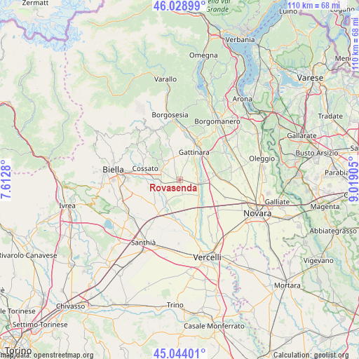
Rovasenda GPS coordinates[2]
45° 32' 19.176" North, 8° 18' 57.312" East
| Map corner | latitude | longitude |
|---|---|---|
| Upper-left | 46.02899°, | 7.6128° |
| Center: | 45.53866°, | 8.31592° |
| Lower-right: | 45.04401°, | 9.01905° |
| Map W x H: | 109.5×109.5 km | = 68×68mi |
| max Lat: | 47.04031° ⇑25.1% North |
| Rovasenda: | 45.53866° |
| min Lat: | ⇓74.9% South 35.50142° |
| min Long | Rovasenda | max Long |
| 6.69888° | 8.31592° | 18.48682° |
| W 10.1%⇐ | ⇒89.9% E |
Elevation
Elevation of Rovasenda is 226 m = 741 ft, and this is 80.7 m = 265 ft below average elevation for this country.
| Max E: |
2085 m = 6841 ft | 51.3% |
| Avg. | 306.7 m = 1006 ft | |
| Rovasenda | 226 m = 741 ft | |
Min E: |
-4 m = -13 ft | 48.7% |
See also: Italy elevation on elevation.city.
Geographical zone
Rovasenda is located in North temperate zone (between Tropic of Cancer and the Arctic Circle). Distance of this North polar circle is 2337.7 km =1452.6 mi to North.| Distance of | km | miles | from Rovasenda |
|---|---|---|---|
| North Pole | 4943.6 | 3071.8 | to North |
| Arctic Circle | 2337.7 | 1452.6 | to North |
| Tropic Cancer | 2457.5 | 1527 | to South |
| Equator | 5063.4 | 3146.2 | to South |


Nearby cities:
15 places around Rovasenda: (largest is in red/bold)
• Arborio
7.3 km =4.5 mi,  130°
130°
• Brusnengo
7.6 km =4.7 mi,  319°
319°
• Buronzo
7.6 km =4.7 mi,  210°
210°
• Carpignano Sesia
7.9 km =4.9 mi,  94°
94°
• Castelletto Cervo
7.3 km =4.5 mi,  254°
254°
• Gattinara
9.1 km =5.7 mi,  24°
24°
• Ghislarengo
5.5 km =3.4 mi,  101°
101°
• Gifflenga
8.3 km =5.2 mi,  232°
232°
• Lenta
5.7 km =3.5 mi,  69°
69°
• Lozzolo
8.9 km =5.5 mi,  3°
3°
• Mottalciata
9.2 km =5.7 mi,  242°
242°
• Roasio
7.7 km =4.8 mi,  341°
341°
• San Giacomo Vercellese
4.6 km =2.9 mi,  169°
169°
• San Maurizio
7.6 km =4.7 mi, 342°
• Sant'Eusebio
6.9 km =4.3 mi,  331°
331°
Sources, notices
• [Note1] Compared only with cities in Italy existing in our database
• [Src1] Map data: © OpenStreetMap contributors (CC-BY-SA)
• [Src2] Other city data from geonames.org with taken over terms of usage.
• [Src3] Geographical zone / Annual Mean Temperature by Robert A. Rohde @ Wikipedia
