Campotosto geodata
Campotosto (Abruzzo) is a seat of a third-order administrative division; located in Italy in Europe/Rome (GMT+2) time zone. With population of 244 people, there are 10923 cities with bigger population in this country. Compared to other cities in Italy, 65.9% of cities are located further ↑North; 72.1% of cities are located further ←West and 99.5% of cities have lower elevation than Campotosto. Note1


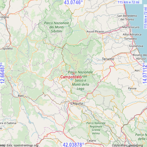
Campotosto GPS coordinates[2]
42° 33' 31.824" North, 13° 22' 4.764" East
| Map corner | latitude | longitude |
|---|---|---|
| Upper-left | 43.0746°, | 12.66487° |
| Center: | 42.55884°, | 13.36799° |
| Lower-right: | 42.03878°, | 14.07112° |
| Map W x H: | 115.2×115.2 km | = 71.6×71.6mi |
| max Lat: | 47.04031° ⇑65.9% North |
| Campotosto: | 42.55884° |
| min Lat: | ⇓34.1% South 35.50142° |
| min Long | Campotosto | max Long |
| 6.69888° | 13.36799° | 18.48682° |
| W 72.1%⇐ | ⇒27.9% E |
Elevation
Elevation of Campotosto is 1407 m = 4616 ft, and this is 1100.3 m = 3610 ft above average elevation for this country.
| Max E: |
2085 m = 6841 ft | 0.5% |
| Campotosto | 1407 m 4616 ft | |
| Avg. | 306.7 m = 1006 ft | |
Min E: |
-4 m = -13 ft | 99.5% |
See also: Italy elevation on elevation.city.
Geographical zone
Campotosto is located in North temperate zone (between Tropic of Cancer and the Arctic Circle). Distance of this Northern Tropic circle is 2126.2 km =1321.2 mi to South.| Distance of | km | miles | from Campotosto |
|---|---|---|---|
| North Pole | 5275 | 3277.7 | to North |
| Arctic Circle | 2669.1 | 1658.5 | to North |
| Tropic Cancer | 2126.2 | 1321.2 | to South |
| Equator | 4732.1 | 2940.4 | to South |


Nearby cities:
15 places around Campotosto: (largest is in red/bold)
• Accumoli
18 km =11.2 mi,  326°
326°
• Amatrice
9.6 km =6 mi,  321°
321°
• Arischia
15.8 km =9.8 mi,  188°
188°
• Barete
14.1 km =8.8 mi,  210°
210°
• Cagnano Amiterno
16.1 km =10 mi,  225°
225°
• Capitignano
6.9 km =4.3 mi, 232°
• Collebrincioni
18.3 km =11.4 mi,  167°
167°
• Cortino
13.4 km =8.3 mi,  58°
58°
• Crognaleto
10.4 km =6.5 mi,  72°
72°
• Fano Adriano
13.9 km =8.6 mi,  92°
92°
• Marana
13.7 km =8.5 mi,  239°
239°
• Montereale
10.8 km =6.7 mi,  248°
248°
• Nerito
9.1 km =5.7 mi,  97°
97°
• Pietracamela
15.8 km =9.8 mi, 104°
• Pizzoli
14.8 km =9.2 mi,  202°
202°
Sources, notices
• [Note1] Compared only with cities in Italy existing in our database
• [Src1] Map data: © OpenStreetMap contributors (CC-BY-SA)
• [Src2] Other city data from geonames.org with taken over terms of usage.
• [Src3] Geographical zone / Annual Mean Temperature by Robert A. Rohde @ Wikipedia
