Rasun Anterselva - Rasen-Antholz geodata
Rasun Anterselva - Rasen-Antholz (Trentino-Alto Adige) is a seat of a third-order administrative division; located in Italy in Europe/Rome (GMT+2) time zone. With population of 2,700 people, there are 3308 cities with bigger population in this country. Compared to other cities in Italy, 99.6% of cities are located further ↓South; 56.5% of cities are located further ←West and 97.2% of cities have lower elevation than Rasun Anterselva - Rasen-Antholz. Note1
Current local time in Rasun Anterselva - Rasen-Antholz:
06:10 AM, MondayDifference from your time zone: hours


Rasun Anterselva - Rasen-Antholz GPS coordinates[2]
46° 46' 42.708" North, 12° 2' 50.244" East
| Map corner | latitude | longitude |
|---|---|---|
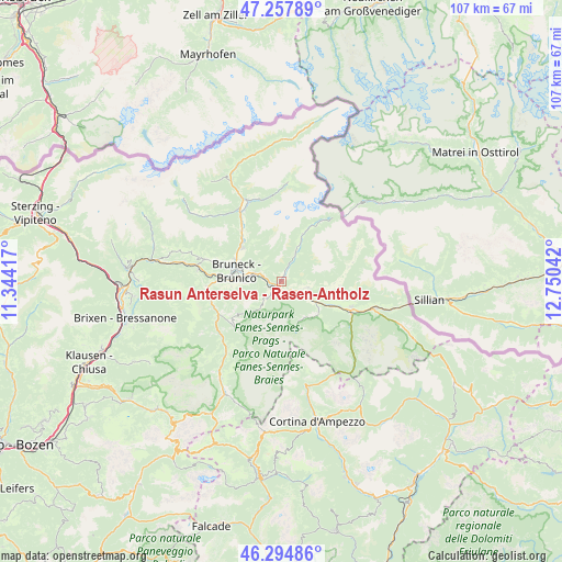
| Upper-left | 47.25789°, | 11.34417° |
| Center: | 46.77853°, | 12.04729° |
| Lower-right: | 46.29486°, | 12.75042° |
| Map W x H: | 107.1×107.1 km | = 66.5×66.5mi |
| max Lat: | 47.04031° ⇑0.4% North |
| Rasun Anterselva - Rasen-Antholz: | 46.77853° |
| min Lat: | ⇓99.6% South 35.50142° |
| min Long | Rasun Anterselv | max Long |
| 6.69888° | 12.04729° | 18.48682° |
| W 56.5%⇐ | ⇒43.5% E |
Elevation
Elevation of Rasun Anterselva - Rasen-Antholz is 1019 m = 3343 ft, and this is 712.3 m = 2337 ft above average elevation for this country.
| Max E: |
2085 m = 6841 ft | 2.8% |
| Rasun Anterselva - Rasen-Antholz | 1019 m 3343 ft | |
| Avg. | 306.7 m = 1006 ft | |
Min E: |
-4 m = -13 ft | 97.2% |
See also: Italy elevation on elevation.city.
Geographical zone
Rasun Anterselva - Rasen-Antholz is located in North temperate zone (between Tropic of Cancer and the Arctic Circle). Distance of this North polar circle is 2199.9 km =1367 mi to North.| Distance of | km | miles | from Rasun Anterselva - Rasen-Antholz |
|---|---|---|---|
| North Pole | 4805.8 | 2986.2 | to North |
| Arctic Circle | 2199.9 | 1367 | to North |
| Tropic Cancer | 2595.4 | 1612.7 | to South |
| Equator | 5201.3 | 3231.9 | to South |


Nearby cities:
15 places around Rasun Anterselva - Rasen-Antholz: (largest is in red/bold)
• Anterselva di Mezzo
9.8 km =6.1 mi,  24°
24°
• Braies
9.2 km =5.7 mi,  134°
134°
• Brunico
8.9 km =5.5 mi,  285°
285°
• Gais
9.9 km =6.2 mi,  310°
310°
• Monguelfo
5 km =3.1 mi,  117°
117°
• Perca
5.1 km =3.2 mi, 288°
• Rasun di Sopra
1.4 km =0.9 mi,  31°
31°
• Riscone
7.3 km =4.5 mi,  268°
268°
• San Lorenzo di Sebato
10.6 km =6.6 mi, 273°
• Teodone
7.7 km =4.8 mi, 290°
• Tesido
5.2 km =3.2 mi,  101°
101°
• Valdaora di Mezzo
2.4 km =1.5 mi,  213°
213°
• Valdaora di Sotto
2.5 km =1.6 mi,  242°
242°
• Valle di Casies - Gsies
10.1 km =6.3 mi, 96°
• Villabassa
10.6 km =6.6 mi, 115°
Sources, notices
• [Note1] Compared only with cities in Italy existing in our database
• [Src1] Map data: © OpenStreetMap contributors (CC-BY-SA)
• [Src2] Other city data from geonames.org with taken over terms of usage.
• [Src3] Geographical zone / Annual Mean Temperature by Robert A. Rohde @ Wikipedia
