Borzonasca geodata
Borzonasca (Liguria) is a seat of a third-order administrative division; located in Italy in Europe/Rome (GMT+2) time zone. With population of 833 people, there are 7487 cities with bigger population in this country. Compared to other cities in Italy, 50.1% of cities are located further ↑North; 74.7% of cities are located further →East and 60.4% of cities have higher elevation than Borzonasca. Note1


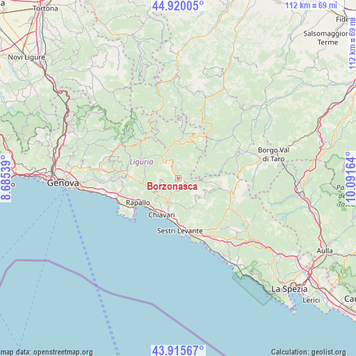
Borzonasca GPS coordinates[2]
44° 25' 12.072" North, 9° 23' 18.636" East
| Map corner | latitude | longitude |
|---|---|---|
| Upper-left | 44.92005°, | 8.68539° |
| Center: | 44.42002°, | 9.38851° |
| Lower-right: | 43.91567°, | 10.09164° |
| Map W x H: | 111.7×111.7 km | = 69.4×69.4mi |
| max Lat: | 47.04031° ⇑50.1% North |
| Borzonasca: | 44.42002° |
| min Lat: | ⇓49.9% South 35.50142° |
| min Long | Borzonasca | max Long |
| 6.69888° | 9.38851° | 18.48682° |
| W 25.3%⇐ | ⇒74.7% E |
Elevation
Elevation of Borzonasca is 160 m = 525 ft, and this is 146.7 m = 481 ft below average elevation for this country.
| Max E: |
2085 m = 6841 ft | 60.4% |
| Avg. | 306.7 m = 1006 ft | |
| Borzonasca | 160 m = 525 ft | |
Min E: |
-4 m = -13 ft | 39.6% |
See also: Italy elevation on elevation.city.
Geographical zone
Borzonasca is located in North temperate zone (between Tropic of Cancer and the Arctic Circle). Distance of this Northern Tropic circle is 2333.1 km =1449.7 mi to South.| Distance of | km | miles | from Borzonasca |
|---|---|---|---|
| North Pole | 5068 | 3149.1 | to North |
| Arctic Circle | 2462.1 | 1529.9 | to North |
| Tropic Cancer | 2333.1 | 1449.7 | to South |
| Equator | 4939 | 3069 | to South |


Nearby cities:
15 places around Borzonasca: (largest is in red/bold)
• Bocco
10.2 km =6.3 mi,  221°
221°
• Carasco
8.5 km =5.3 mi,  203°
203°
• Chiesa Nuova
8.3 km =5.2 mi,  227°
227°
• Cogorno
11.1 km =6.9 mi,  187°
187°
• Conscenti
8.4 km =5.2 mi,  176°
176°
• Coreglia Ligure
10.7 km =6.6 mi,  250°
250°
• Favale di Malvaro
10.8 km =6.7 mi,  289°
289°
• Leivi
9.6 km =6 mi, 219°
• Lorsica
9 km =5.6 mi,  280°
280°
• Mezzanego
4.2 km =2.6 mi, 192°
• Orero
9.7 km =6 mi,  262°
262°
• Prati
4.3 km =2.7 mi, 193°
• Rezzoaglio
11.8 km =7.3 mi,  359°
359°
• Rivarola
8.9 km =5.5 mi, 197°
• San Salvatore
10.3 km =6.4 mi, 195°
Sources, notices
• [Note1] Compared only with cities in Italy existing in our database
• [Src1] Map data: © OpenStreetMap contributors (CC-BY-SA)
• [Src2] Other city data from geonames.org with taken over terms of usage.
• [Src3] Geographical zone / Annual Mean Temperature by Robert A. Rohde @ Wikipedia
