Blessano geodata
Blessano (Friuli Venezia Giulia) is a populated place; located in Italy in Europe/Rome (GMT+2) time zone. With population of 751 people, there are 7946 cities with bigger population in this country. Compared to other cities in Italy, 92.8% of cities are located further ↓South; 69.5% of cities are located further ←West and 72% of cities have higher elevation than Blessano. Note1
Administrative division(s):
- Level 1: Friuli Venezia Giulia
- Level 2: Provincia di Udine
- Level 3: Basiliano


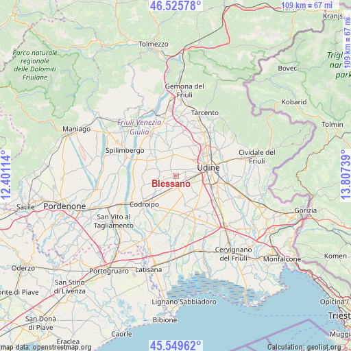
Blessano GPS coordinates[2]
46° 2' 23.496" North, 13° 6' 15.336" East
| Map corner | latitude | longitude |
|---|---|---|
| Upper-left | 46.52578°, | 12.40114° |
| Center: | 46.03986°, | 13.10426° |
| Lower-right: | 45.54962°, | 13.80739° |
| Map W x H: | 108.5×108.5 km | = 67.4×67.4mi |
| max Lat: | 47.04031° ⇑7.2% North |
| Blessano: | 46.03986° |
| min Lat: | ⇓92.8% South 35.50142° |
| min Long | Blessano | max Long |
| 6.69888° | 13.10426° | 18.48682° |
| W 69.5%⇐ | ⇒30.5% E |
Elevation
Elevation of Blessano is 88 m = 289 ft, and this is 218.7 m = 718 ft below average elevation for this country.
| Max E: |
2085 m = 6841 ft | 72% |
| Avg. | 306.7 m = 1006 ft | |
| Blessano | 88 m = 289 ft | |
Min E: |
-4 m = -13 ft | 28% |
See also: Italy elevation on elevation.city.
Geographical zone
Blessano is located in North temperate zone (between Tropic of Cancer and the Arctic Circle). Distance of this North polar circle is 2282 km =1418 mi to North.| Distance of | km | miles | from Blessano |
|---|---|---|---|
| North Pole | 4887.9 | 3037.2 | to North |
| Arctic Circle | 2282 | 1418 | to North |
| Tropic Cancer | 2513.2 | 1561.6 | to South |
| Equator | 5119.2 | 3180.9 | to South |


Nearby cities:
15 places around Blessano: (largest is in red/bold)
• Basiliano
3.9 km =2.4 mi,  222°
222°
• Basiliano-Vissandone
2.1 km =1.3 mi,  204°
204°
• Bressa
3.4 km =2.1 mi,  100°
100°
• Campoformido
4.7 km =2.9 mi,  118°
118°
• Colloredo di Prato
3.3 km =2.1 mi,  67°
67°
• Martignacco
6.5 km =4 mi,  24°
24°
• Mereto di Tomba
4.8 km =3 mi,  285°
285°
• Nespoledo-Villacaccia
6.4 km =4 mi,  189°
189°
• Nogaredo di Prato
4.6 km =2.9 mi,  30°
30°
• Pantianicco
5.6 km =3.5 mi,  251°
251°
• Pasian di Prato
6.5 km =4 mi,  83°
83°
• Plasencis
3.8 km =2.4 mi,  326°
326°
• San Vito di Fagagna
6.4 km =4 mi, 332°
• Variano
1.6 km =1 mi,  153°
153°
• Villaorba
4.2 km =2.6 mi, 218°
Sources, notices
• [Note1] Compared only with cities in Italy existing in our database
• [Src1] Map data: © OpenStreetMap contributors (CC-BY-SA)
• [Src2] Other city data from geonames.org with taken over terms of usage.
• [Src3] Geographical zone / Annual Mean Temperature by Robert A. Rohde @ Wikipedia
