Villaorba geodata
Villaorba (Friuli Venezia Giulia) is a populated place; located in Italy in Europe/Rome (GMT+2) time zone. With population of 646 people, there are 8661 cities with bigger population in this country. Compared to other cities in Italy, 92.2% of cities are located further ↓South; 69.1% of cities are located further ←West and 76.3% of cities have higher elevation than Villaorba. Note1
Administrative division(s):
- Level 1: Friuli Venezia Giulia
- Level 2: Provincia di Udine
- Level 3: Basiliano


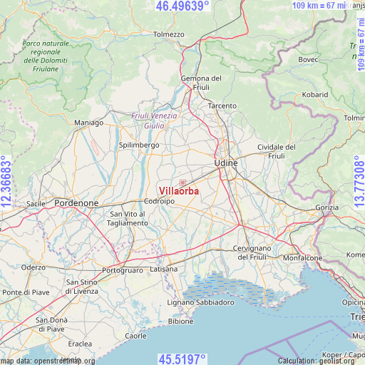
Villaorba GPS coordinates[2]
46° 0' 36.72" North, 13° 4' 11.82" East
| Map corner | latitude | longitude |
|---|---|---|
| Upper-left | 46.49639°, | 12.36683° |
| Center: | 46.0102°, | 13.06995° |
| Lower-right: | 45.5197°, | 13.77308° |
| Map W x H: | 108.6×108.6 km | = 67.5×67.5mi |
| max Lat: | 47.04031° ⇑7.8% North |
| Villaorba: | 46.0102° |
| min Lat: | ⇓92.2% South 35.50142° |
| min Long | Villaorba | max Long |
| 6.69888° | 13.06995° | 18.48682° |
| W 69.1%⇐ | ⇒30.9% E |
Elevation
Elevation of Villaorba is 68 m = 223 ft, and this is 238.7 m = 783 ft below average elevation for this country.
| Max E: |
2085 m = 6841 ft | 76.3% |
| Avg. | 306.7 m = 1006 ft | |
| Villaorba | 68 m = 223 ft | |
Min E: |
-4 m = -13 ft | 23.7% |
See also: Italy elevation on elevation.city.
Geographical zone
Villaorba is located in North temperate zone (between Tropic of Cancer and the Arctic Circle). Distance of this North polar circle is 2285.3 km =1420 mi to North.| Distance of | km | miles | from Villaorba |
|---|---|---|---|
| North Pole | 4891.2 | 3039.2 | to North |
| Arctic Circle | 2285.3 | 1420 | to North |
| Tropic Cancer | 2509.9 | 1559.6 | to South |
| Equator | 5115.9 | 3178.9 | to South |


Nearby cities:
15 places around Villaorba: (largest is in red/bold)
• Basiliano
0.4 km =0.2 mi,  0°
0°
• Basiliano-Vissandone
2.3 km =1.4 mi,  51°
51°
• Blessano
4.2 km =2.6 mi,  38°
38°
• Bressa
6.5 km =4 mi,  65°
65°
• Campoformido
6.8 km =4.2 mi,  81°
81°
• Galleriano
6.7 km =4.2 mi,  141°
141°
• Mereto di Tomba
5 km =3.1 mi,  336°
336°
• Nespoledo-Villacaccia
3.4 km =2.1 mi,  151°
151°
• Pantianicco
3 km =1.9 mi,  299°
299°
• Plasencis
6.5 km =4 mi, 4°
• Pozzecco
6 km =3.7 mi,  164°
164°
• San Lorenzo
5.7 km =3.5 mi,  257°
257°
• Sclaunicco
6.4 km =4 mi,  126°
126°
• Sedegliano
7.2 km =4.5 mi,  273°
273°
• Variano
3.8 km =2.4 mi,  61°
61°
Sources, notices
• [Note1] Compared only with cities in Italy existing in our database
• [Src1] Map data: © OpenStreetMap contributors (CC-BY-SA)
• [Src2] Other city data from geonames.org with taken over terms of usage.
• [Src3] Geographical zone / Annual Mean Temperature by Robert A. Rohde @ Wikipedia
