Balvano geodata
Balvano (Basilicate) is a seat of a third-order administrative division; located in Italy in Europe/Rome (GMT+2) time zone. With population of 1,306 people, there are 5616 cities with bigger population in this country. Compared to other cities in Italy, 83% of cities are located further ↑North; 90.6% of cities are located further ←West and 72.9% of cities have lower elevation than Balvano. Note1


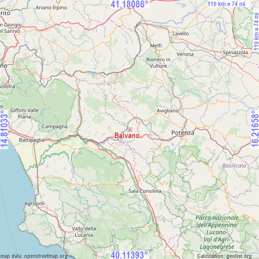
Balvano GPS coordinates[2]
40° 38' 58.308" North, 15° 30' 48.42" East
| Map corner | latitude | longitude |
|---|---|---|
| Upper-left | 41.18086°, | 14.81033° |
| Center: | 40.64953°, | 15.51345° |
| Lower-right: | 40.11393°, | 16.21658° |
| Map W x H: | 118.6×118.6 km | = 73.7×73.7mi |
| max Lat: | 47.04031° ⇑83% North |
| Balvano: | 40.64953° |
| min Lat: | ⇓17% South 35.50142° |
| min Long | Balvano | max Long |
| 6.69888° | 15.51345° | 18.48682° |
| W 90.6%⇐ | ⇒9.4% E |
Elevation
Elevation of Balvano is 424 m = 1391 ft, and this is 117.3 m = 385 ft above average elevation for this country.
| Max E: |
2085 m = 6841 ft | 27.1% |
| Balvano | 424 m 1391 ft | |
| Avg. | 306.7 m = 1006 ft | |
Min E: |
-4 m = -13 ft | 72.9% |
See also: Italy elevation on elevation.city.
Geographical zone
Balvano is located in North temperate zone (between Tropic of Cancer and the Arctic Circle). Distance of this Northern Tropic circle is 1913.9 km =1189.2 mi to South.| Distance of | km | miles | from Balvano |
|---|---|---|---|
| North Pole | 5487.3 | 3409.6 | to North |
| Arctic Circle | 2881.4 | 1790.4 | to North |
| Tropic Cancer | 1913.9 | 1189.2 | to South |
| Equator | 4519.8 | 2808.5 | to South |


Nearby cities:
15 places around Balvano: (largest is in red/bold)
• Ariola
7.1 km =4.4 mi,  250°
250°
• Auletta
12.4 km =7.7 mi,  217°
217°
• Baragiano
7.6 km =4.7 mi,  63°
63°
• Buccino
11.3 km =7 mi,  262°
262°
• Caggiano
9.8 km =6.1 mi,  188°
188°
• Muro Lucano
11.8 km =7.3 mi,  349°
349°
• Picerno
10.9 km =6.8 mi,  95°
95°
• Ricigliano
3.6 km =2.2 mi,  304°
304°
• Salvitelle
8.1 km =5 mi, 215°
• San Gregorio Magno
9.7 km =6 mi,  276°
276°
• Sant'Angelo le Fratte
12.3 km =7.6 mi,  160°
160°
• Savoia di Lucania
9.5 km =5.9 mi, 160°
• Scalo Romagnano al Monte
7.1 km =4.4 mi,  231°
231°
• Scalo di Baragiano
7.3 km =4.5 mi,  45°
45°
• Vietri di Potenza
5.5 km =3.4 mi,  184°
184°
Sources, notices
• [Note1] Compared only with cities in Italy existing in our database
• [Src1] Map data: © OpenStreetMap contributors (CC-BY-SA)
• [Src2] Other city data from geonames.org with taken over terms of usage.
• [Src3] Geographical zone / Annual Mean Temperature by Robert A. Rohde @ Wikipedia
