Baragiano geodata
Baragiano (Basilicate) is a seat of a third-order administrative division; located in Italy in Europe/Rome (GMT+2) time zone. With population of 549 people, there are 9458 cities with bigger population in this country. Compared to other cities in Italy, 82.6% of cities are located further ↑North; 90.9% of cities are located further ←West and 85.1% of cities have lower elevation than Baragiano. Note1


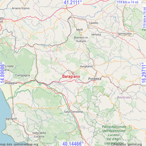
Baragiano GPS coordinates[2]
40° 40' 48.036" North, 15° 35' 38.328" East
| Map corner | latitude | longitude |
|---|---|---|
| Upper-left | 41.2111°, | 14.89086° |
| Center: | 40.68001°, | 15.59398° |
| Lower-right: | 40.14466°, | 16.29711° |
| Map W x H: | 118.6×118.6 km | = 73.7×73.7mi |
| max Lat: | 47.04031° ⇑82.6% North |
| Baragiano: | 40.68001° |
| min Lat: | ⇓17.4% South 35.50142° |
| min Long | Baragiano | max Long |
| 6.69888° | 15.59398° | 18.48682° |
| W 90.9%⇐ | ⇒9.1% E |
Elevation
Elevation of Baragiano is 616 m = 2021 ft, and this is 309.3 m = 1015 ft above average elevation for this country.
| Max E: |
2085 m = 6841 ft | 14.9% |
| Baragiano | 616 m 2021 ft | |
| Avg. | 306.7 m = 1006 ft | |
Min E: |
-4 m = -13 ft | 85.1% |
See also: Italy elevation on elevation.city.
Geographical zone
Baragiano is located in North temperate zone (between Tropic of Cancer and the Arctic Circle). Distance of this Northern Tropic circle is 1917.3 km =1191.4 mi to South.| Distance of | km | miles | from Baragiano |
|---|---|---|---|
| North Pole | 5483.9 | 3407.5 | to North |
| Arctic Circle | 2878 | 1788.3 | to North |
| Tropic Cancer | 1917.3 | 1191.4 | to South |
| Equator | 4523.2 | 2810.6 | to South |


Nearby cities:
15 places around Baragiano: (largest is in red/bold)
• Ariola
14.6 km =9.1 mi,  246°
246°
• Avigliano
12.1 km =7.5 mi,  61°
61°
• Balvano
7.6 km =4.7 mi,  243°
243°
• Bella
10 km =6.2 mi,  333°
333°
• Muro Lucano
12.1 km =7.5 mi,  312°
312°
• Picerno
6.1 km =3.8 mi,  137°
137°
• Ricigliano
9.9 km =6.2 mi,  262°
262°
• Ruoti
8.6 km =5.3 mi, 61°
• San Cataldo
9.1 km =5.7 mi,  41°
41°
• Savoia di Lucania
12.8 km =8 mi,  196°
196°
• Scalo Romagnano al Monte
14.6 km =9.1 mi, 237°
• Scalo di Baragiano
2.3 km =1.4 mi,  316°
316°
• Serra
11.8 km =7.3 mi, 135°
• Tito
12.8 km =8 mi,  147°
147°
• Vietri di Potenza
11.5 km =7.1 mi,  219°
219°
Sources, notices
• [Note1] Compared only with cities in Italy existing in our database
• [Src1] Map data: © OpenStreetMap contributors (CC-BY-SA)
• [Src2] Other city data from geonames.org with taken over terms of usage.
• [Src3] Geographical zone / Annual Mean Temperature by Robert A. Rohde @ Wikipedia
