Ariola geodata
Ariola (Campania) is a seat of a third-order administrative division; located in Italy in Europe/Rome (GMT+2) time zone. With population of 254 people, there are 10875 cities with bigger population in this country. Compared to other cities in Italy, 83.2% of cities are located further ↑North; 90.3% of cities are located further ←West and 88.4% of cities have lower elevation than Ariola. Note1
Administrative division(s):
- Level 1: Campania
- Level 2: Provincia di Salerno
- Level 3: Romagnano al Monte


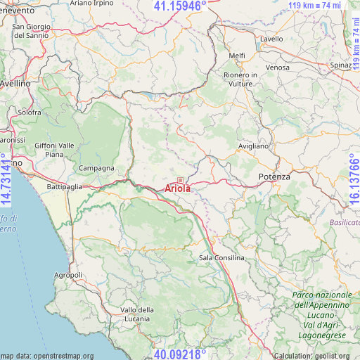
Ariola GPS coordinates[2]
40° 37' 40.62" North, 15° 26' 4.308" East
| Map corner | latitude | longitude |
|---|---|---|
| Upper-left | 41.15946°, | 14.73141° |
| Center: | 40.62795°, | 15.43453° |
| Lower-right: | 40.09218°, | 16.13766° |
| Map W x H: | 118.7×118.7 km | = 73.8×73.8mi |
| max Lat: | 47.04031° ⇑83.2% North |
| Ariola: | 40.62795° |
| min Lat: | ⇓16.8% South 35.50142° |
| min Long | Ariola | max Long |
| 6.69888° | 15.43453° | 18.48682° |
| W 90.3%⇐ | ⇒9.7% E |
Elevation
Elevation of Ariola is 679 m = 2228 ft, and this is 372.3 m = 1221 ft above average elevation for this country.
| Max E: |
2085 m = 6841 ft | 11.6% |
| Ariola | 679 m 2228 ft | |
| Avg. | 306.7 m = 1006 ft | |
Min E: |
-4 m = -13 ft | 88.4% |
See also: Italy elevation on elevation.city.
Geographical zone
Ariola is located in North temperate zone (between Tropic of Cancer and the Arctic Circle). Distance of this Northern Tropic circle is 1911.5 km =1187.8 mi to South.| Distance of | km | miles | from Ariola |
|---|---|---|---|
| North Pole | 5489.7 | 3411.1 | to North |
| Arctic Circle | 2883.8 | 1791.9 | to North |
| Tropic Cancer | 1911.5 | 1187.8 | to South |
| Equator | 4517.4 | 2807 | to South |


Nearby cities:
15 places around Ariola: (largest is in red/bold)
• Auletta
7.5 km =4.7 mi,  187°
187°
• Balvano
7.1 km =4.4 mi,  70°
70°
• Buccino
4.6 km =2.9 mi,  282°
282°
• Caggiano
9 km =5.6 mi,  144°
144°
• Palomonte
12.6 km =7.8 mi,  287°
287°
• Pertosa
9.5 km =5.9 mi,  172°
172°
• Petina
11.8 km =7.3 mi,  205°
205°
• Polla
13.7 km =8.5 mi,  157°
157°
• Ricigliano
5.8 km =3.6 mi,  39°
39°
• Salvitelle
4.6 km =2.9 mi,  154°
154°
• San Gregorio Magno
4.6 km =2.9 mi,  319°
319°
• Savoia di Lucania
11.8 km =7.3 mi,  123°
123°
• Scalo Romagnano al Monte
2.3 km =1.4 mi, 150°
• Sicignano degli Alburni
13.3 km =8.3 mi,  234°
234°
• Vietri di Potenza
6.9 km =4.3 mi, 116°
Sources, notices
• [Note1] Compared only with cities in Italy existing in our database
• [Src1] Map data: © OpenStreetMap contributors (CC-BY-SA)
• [Src2] Other city data from geonames.org with taken over terms of usage.
• [Src3] Geographical zone / Annual Mean Temperature by Robert A. Rohde @ Wikipedia
