Avio geodata
Avio (Trentino-Alto Adige) is a seat of a third-order administrative division; located in Italy in Europe/Rome (GMT+2) time zone. With population of 1,893 people, there are 4330 cities with bigger population in this country. Compared to other cities in Italy, 82.8% of cities are located further ↓South; 58.1% of cities are located further →East and 63.1% of cities have higher elevation than Avio. Note1
Administrative division(s):
- Level 1: Trentino-Alto Adige
- Level 2: Provincia autonoma di Trento
- Level 3: Avio


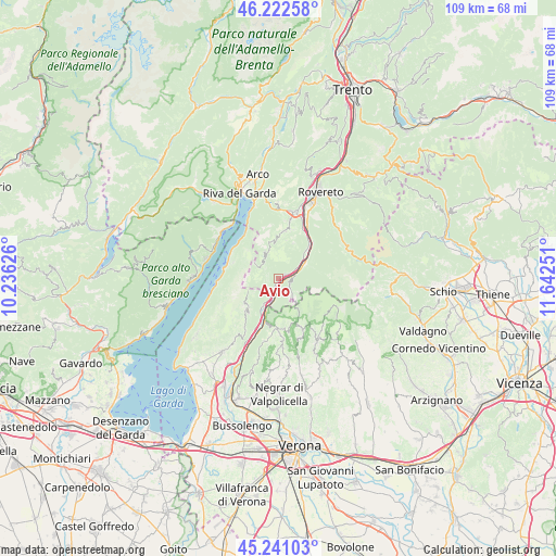
Avio GPS coordinates[2]
45° 44' 2.256" North, 10° 56' 21.768" East
| Map corner | latitude | longitude |
|---|---|---|
| Upper-left | 46.22258°, | 10.23626° |
| Center: | 45.73396°, | 10.93938° |
| Lower-right: | 45.24103°, | 11.64251° |
| Map W x H: | 109.1×109.1 km | = 67.8×67.8mi |
| max Lat: | 47.04031° ⇑17.2% North |
| Avio: | 45.73396° |
| min Lat: | ⇓82.8% South 35.50142° |
| min Long | Avio | max Long |
| 6.69888° | 10.93938° | 18.48682° |
| W 41.9%⇐ | ⇒58.1% E |
Elevation
Elevation of Avio is 140 m = 459 ft, and this is 166.7 m = 547 ft below average elevation for this country.
| Max E: |
2085 m = 6841 ft | 63.1% |
| Avg. | 306.7 m = 1006 ft | |
| Avio | 140 m = 459 ft | |
Min E: |
-4 m = -13 ft | 36.9% |
See also: Italy elevation on elevation.city.
Geographical zone
Avio is located in North temperate zone (between Tropic of Cancer and the Arctic Circle). Distance of this North polar circle is 2316 km =1439.1 mi to North.| Distance of | km | miles | from Avio |
|---|---|---|---|
| North Pole | 4921.9 | 3058.3 | to North |
| Arctic Circle | 2316 | 1439.1 | to North |
| Tropic Cancer | 2479.2 | 1540.5 | to South |
| Equator | 5085.1 | 3159.7 | to South |


Nearby cities:
15 places around Avio: (largest is in red/bold)
• Ala
5.9 km =3.7 mi,  59°
59°
• Brentino Belluno
9.3 km =5.8 mi,  202°
202°
• Brentonico
9.5 km =5.9 mi,  7°
7°
• Chizzola
10.1 km =6.3 mi,  31°
31°
• Crosano
9.9 km =6.2 mi,  15°
15°
• Erbezzo
11.5 km =7.1 mi,  155°
155°
• Ferrara di Monte Baldo
9.1 km =5.7 mi,  223°
223°
• Malcesine
10.6 km =6.6 mi,  286°
286°
• Marco
13.2 km =8.2 mi, 24°
• Pilcante
6.3 km =3.9 mi,  49°
49°
• Rivalta
9.3 km =5.8 mi, 202°
• Sabbionara
1.6 km =1 mi, 58°
• Sant'Anna d'Alfaedo
11.9 km =7.4 mi,  175°
175°
• Santa Margherita
9.8 km =6.1 mi,  43°
43°
• Serravalle
10.3 km =6.4 mi, 34°
Sources, notices
• [Note1] Compared only with cities in Italy existing in our database
• [Src1] Map data: © OpenStreetMap contributors (CC-BY-SA)
• [Src2] Other city data from geonames.org with taken over terms of usage.
• [Src3] Geographical zone / Annual Mean Temperature by Robert A. Rohde @ Wikipedia
