Lumignacco geodata
Lumignacco (Friuli Venezia Giulia) is a populated place; located in Italy in Europe/Rome (GMT+2) time zone. With population of 796 people, there are 7669 cities with bigger population in this country. Compared to other cities in Italy, 92% of cities are located further ↓South; 70.8% of cities are located further ←West and 75.6% of cities have higher elevation than Lumignacco. Note1
Administrative division(s):
- Level 1: Friuli Venezia Giulia
- Level 2: Provincia di Udine
- Level 3: Pavia di Udine


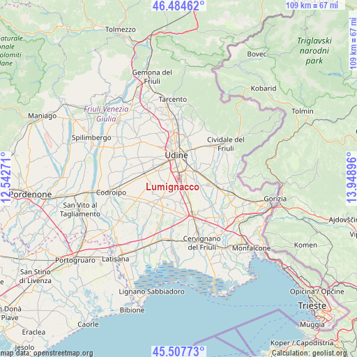
Lumignacco GPS coordinates[2]
45° 59' 53.988" North, 13° 14' 44.988" East
| Map corner | latitude | longitude |
|---|---|---|
| Upper-left | 46.48462°, | 12.54271° |
| Center: | 45.99833°, | 13.24583° |
| Lower-right: | 45.50773°, | 13.94896° |
| Map W x H: | 108.6×108.6 km | = 67.5×67.5mi |
| max Lat: | 47.04031° ⇑8% North |
| Lumignacco: | 45.99833° |
| min Lat: | ⇓92% South 35.50142° |
| min Long | Lumignacco | max Long |
| 6.69888° | 13.24583° | 18.48682° |
| W 70.8%⇐ | ⇒29.2% E |
Elevation
Elevation of Lumignacco is 71 m = 233 ft, and this is 235.7 m = 773 ft below average elevation for this country.
| Max E: |
2085 m = 6841 ft | 75.6% |
| Avg. | 306.7 m = 1006 ft | |
| Lumignacco | 71 m = 233 ft | |
Min E: |
-4 m = -13 ft | 24.4% |
See also: Italy elevation on elevation.city.
Geographical zone
Lumignacco is located in North temperate zone (between Tropic of Cancer and the Arctic Circle). Distance of this North polar circle is 2286.6 km =1420.8 mi to North.| Distance of | km | miles | from Lumignacco |
|---|---|---|---|
| North Pole | 4892.5 | 3040.1 | to North |
| Arctic Circle | 2286.6 | 1420.8 | to North |
| Tropic Cancer | 2508.6 | 1558.8 | to South |
| Equator | 5114.5 | 3178 | to South |


Nearby cities:
15 places around Lumignacco: (largest is in red/bold)
• Basaldella
3.7 km =2.3 mi,  323°
323°
• Buttrio
6.9 km =4.3 mi,  78°
78°
• Campoformido
7.2 km =4.5 mi,  289°
289°
• Cargnacco
1 km =0.6 mi,  307°
307°
• Carpeneto
5.3 km =3.3 mi,  267°
267°
• Lauzacco
3.3 km =2.1 mi,  125°
125°
• Lavariano
4.9 km =3 mi,  196°
196°
• Pasian di Prato
7 km =4.3 mi, 320°
• Pavia di Udine
4.5 km =2.8 mi,  94°
94°
• Percoto
6.5 km =4 mi,  113°
113°
• Pozzuolo del Friuli
4 km =2.5 mi,  248°
248°
• Pradamano
5.9 km =3.7 mi,  47°
47°
• Risano
2.8 km =1.7 mi,  165°
165°
• Sammardenchia
1.9 km =1.2 mi,  220°
220°
• Zugliano-Terenzano-Cargnacco
2.5 km =1.6 mi, 294°
Sources, notices
• [Note1] Compared only with cities in Italy existing in our database
• [Src1] Map data: © OpenStreetMap contributors (CC-BY-SA)
• [Src2] Other city data from geonames.org with taken over terms of usage.
• [Src3] Geographical zone / Annual Mean Temperature by Robert A. Rohde @ Wikipedia
