Fossò geodata
Fossò (Veneto) is a seat of a third-order administrative division; located in Italy in Europe/Rome (GMT+2) time zone. With population of 5,021 people, there are 1948 cities with bigger population in this country. Compared to other cities in Italy, 69.8% of cities are located further ↓South; 56.5% of cities are located further ←West and 97.8% of cities have higher elevation than Fossò. Note1


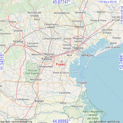
Fossò GPS coordinates[2]
45° 23' 8.88" North, 12° 2' 46.572" East
| Map corner | latitude | longitude |
|---|---|---|
| Upper-left | 45.87747°, | 11.34315° |
| Center: | 45.3858°, | 12.04627° |
| Lower-right: | 44.88982°, | 12.7494° |
| Map W x H: | 109.8×109.8 km | = 68.2×68.2mi |
| max Lat: | 47.04031° ⇑30.2% North |
| Fossò: | 45.3858° |
| min Lat: | ⇓69.8% South 35.50142° |
| min Long | Fossò | max Long |
| 6.69888° | 12.04627° | 18.48682° |
| W 56.5%⇐ | ⇒43.5% E |
Elevation
Elevation of Fossò is 4 m = 13 ft, and this is 302.7 m = 993 ft below average elevation for this country.
| Max E: |
2085 m = 6841 ft | 97.8% |
| Avg. | 306.7 m = 1006 ft | |
| Fossò | 4 m = 13 ft | |
Min E: |
-4 m = -13 ft | 2.2% |
See also: Italy elevation on elevation.city.
Geographical zone
Fossò is located in North temperate zone (between Tropic of Cancer and the Arctic Circle). Distance of this North polar circle is 2354.7 km =1463.1 mi to North.| Distance of | km | miles | from Fossò |
|---|---|---|---|
| North Pole | 4960.6 | 3082.4 | to North |
| Arctic Circle | 2354.7 | 1463.1 | to North |
| Tropic Cancer | 2440.5 | 1516.5 | to South |
| Equator | 5046.4 | 3135.7 | to South |


Nearby cities:
15 places around Fossò: (largest is in red/bold)
• Brigo-Paluello
2.8 km =1.7 mi,  7°
7°
• Campagna Lupia
5.3 km =3.3 mi,  131°
131°
• Campolongo Maggiore Liettoli
5.4 km =3.4 mi,  198°
198°
• Camponogara
3.2 km =2 mi,  102°
102°
• Dolo
5.3 km =3.3 mi,  34°
34°
• Fiesso
3.9 km =2.4 mi,  345°
345°
• Fiesso d'Artico
4.2 km =2.6 mi,  341°
341°
• Galta
1.9 km =1.2 mi,  287°
287°
• Oltre Brenta
4.8 km =3 mi,  307°
307°
• Sambruson
5.2 km =3.2 mi,  58°
58°
• Sandon
2.5 km =1.6 mi,  186°
186°
• Saonara
5.3 km =3.3 mi,  244°
244°
• Stra
3.8 km =2.4 mi,  318°
318°
• Tombelle
5.2 km =3.2 mi, 285°
• Vigonovo
3.1 km =1.9 mi,  272°
272°
Sources, notices
• [Note1] Compared only with cities in Italy existing in our database
• [Src1] Map data: © OpenStreetMap contributors (CC-BY-SA)
• [Src2] Other city data from geonames.org with taken over terms of usage.
• [Src3] Geographical zone / Annual Mean Temperature by Robert A. Rohde @ Wikipedia
