Polazzo geodata
Polazzo (Friuli Venezia Giulia) is a populated place; located in Italy in Europe/Rome (GMT+2) time zone. With population of 587 people, there are 9116 cities with bigger population in this country. Compared to other cities in Italy, 87.8% of cities are located further ↓South; 73.4% of cities are located further ←West and 90.1% of cities have higher elevation than Polazzo. Note1
Administrative division(s):
- Level 1: Friuli Venezia Giulia
- Level 2: Provincia di Gorizia
- Level 3: Fogliano Redipuglia


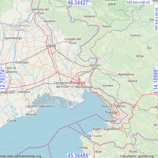
Polazzo GPS coordinates[2]
45° 51' 24.228" North, 13° 29' 12.696" East
| Map corner | latitude | longitude |
|---|---|---|
| Upper-left | 46.34427°, | 12.78374° |
| Center: | 45.85673°, | 13.48686° |
| Lower-right: | 45.36488°, | 14.18999° |
| Map W x H: | 108.9×108.9 km | = 67.7×67.7mi |
| max Lat: | 47.04031° ⇑12.2% North |
| Polazzo: | 45.85673° |
| min Lat: | ⇓87.8% South 35.50142° |
| min Long | Polazzo | max Long |
| 6.69888° | 13.48686° | 18.48682° |
| W 73.4%⇐ | ⇒26.6% E |
Elevation
Elevation of Polazzo is 18 m = 59 ft, and this is 288.7 m = 947 ft below average elevation for this country.
| Max E: |
2085 m = 6841 ft | 90.1% |
| Avg. | 306.7 m = 1006 ft | |
| Polazzo | 18 m = 59 ft | |
Min E: |
-4 m = -13 ft | 9.9% |
See also: Italy elevation on elevation.city.
Geographical zone
Polazzo is located in North temperate zone (between Tropic of Cancer and the Arctic Circle). Distance of this North polar circle is 2302.4 km =1430.6 mi to North.| Distance of | km | miles | from Polazzo |
|---|---|---|---|
| North Pole | 4908.3 | 3049.9 | to North |
| Arctic Circle | 2302.4 | 1430.6 | to North |
| Tropic Cancer | 2492.9 | 1549 | to South |
| Equator | 5098.8 | 3168.2 | to South |


Nearby cities:
15 places around Polazzo: (largest is in red/bold)
• Begliano
4.4 km =2.7 mi,  201°
201°
• Doberdò del Lago
4.3 km =2.7 mi,  108°
108°
• Farra d'Isonzo
6.1 km =3.8 mi,  21°
21°
• Fogliano
1 km =0.6 mi,  339°
339°
• Gradisca d'Isonzo
4.1 km =2.5 mi, 16°
• Pieris
5.7 km =3.5 mi,  210°
210°
• Poggio Terzarmata
4.3 km =2.7 mi,  36°
36°
• Redipuglia
1.2 km =0.7 mi,  181°
181°
• Romans d'Isonzo
4.9 km =3 mi,  315°
315°
• Ronchi dei Legionari
3.5 km =2.2 mi,  157°
157°
• Sagrado
1.9 km =1.2 mi,  353°
353°
• San Pier d'Isonzo
2 km =1.2 mi,  227°
227°
• Staranzano
6.2 km =3.9 mi,  168°
168°
• Turriaco
5.2 km =3.2 mi,  220°
220°
• Villesse
3.5 km =2.2 mi,  285°
285°
Sources, notices
• [Note1] Compared only with cities in Italy existing in our database
• [Src1] Map data: © OpenStreetMap contributors (CC-BY-SA)
• [Src2] Other city data from geonames.org with taken over terms of usage.
• [Src3] Geographical zone / Annual Mean Temperature by Robert A. Rohde @ Wikipedia
