Villesse geodata
Villesse (Friuli Venezia Giulia) is a seat of a third-order administrative division; located in Italy in Europe/Rome (GMT+2) time zone. With population of 1,659 people, there are 4760 cities with bigger population in this country. Compared to other cities in Italy, 88.1% of cities are located further ↓South; 72.9% of cities are located further ←West and 91.1% of cities have higher elevation than Villesse. Note1
Administrative division(s):
- Level 1: Friuli Venezia Giulia
- Level 2: Provincia di Gorizia
- Level 3: Villesse


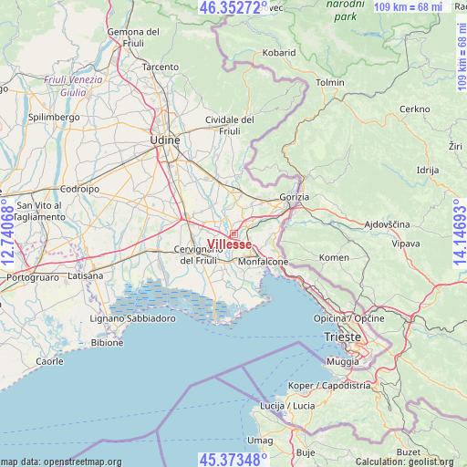
Villesse GPS coordinates[2]
45° 51' 54.936" North, 13° 26' 37.68" East
| Map corner | latitude | longitude |
|---|---|---|
| Upper-left | 46.35272°, | 12.74068° |
| Center: | 45.86526°, | 13.4438° |
| Lower-right: | 45.37348°, | 14.14693° |
| Map W x H: | 108.9×108.9 km | = 67.7×67.7mi |
| max Lat: | 47.04031° ⇑11.9% North |
| Villesse: | 45.86526° |
| min Lat: | ⇓88.1% South 35.50142° |
| min Long | Villesse | max Long |
| 6.69888° | 13.4438° | 18.48682° |
| W 72.9%⇐ | ⇒27.1% E |
Elevation
Elevation of Villesse is 16 m = 52 ft, and this is 290.7 m = 954 ft below average elevation for this country.
| Max E: |
2085 m = 6841 ft | 91.1% |
| Avg. | 306.7 m = 1006 ft | |
| Villesse | 16 m = 52 ft | |
Min E: |
-4 m = -13 ft | 8.9% |
See also: Italy elevation on elevation.city.
Geographical zone
Villesse is located in North temperate zone (between Tropic of Cancer and the Arctic Circle). Distance of this North polar circle is 2301.4 km =1430 mi to North.| Distance of | km | miles | from Villesse |
|---|---|---|---|
| North Pole | 4907.3 | 3049.3 | to North |
| Arctic Circle | 2301.4 | 1430 | to North |
| Tropic Cancer | 2493.8 | 1549.6 | to South |
| Equator | 5099.7 | 3168.8 | to South |


Nearby cities:
15 places around Villesse: (largest is in red/bold)
• Begliano
5.3 km =3.3 mi,  161°
161°
• Campolongo al Torre
3.7 km =2.3 mi,  267°
267°
• Campolongo al Torre-Cavenzano
4.2 km =2.6 mi, 266°
• Fogliano
3 km =1.9 mi,  89°
89°
• Gradisca d'Isonzo
5.4 km =3.4 mi,  55°
55°
• Mariano del Friuli
5.7 km =3.5 mi,  12°
12°
• Perteole
4.9 km =3 mi,  252°
252°
• Pieris
5.9 km =3.7 mi,  175°
175°
• Polazzo
3.5 km =2.2 mi,  105°
105°
• Redipuglia
3.9 km =2.4 mi,  123°
123°
• Romans d'Isonzo
2.6 km =1.6 mi,  356°
356°
• Ruda
4.3 km =2.7 mi,  229°
229°
• Sagrado
3.3 km =2.1 mi,  72°
72°
• San Pier d'Isonzo
3 km =1.9 mi,  141°
141°
• Turriaco
4.9 km =3 mi, 180°
Sources, notices
• [Note1] Compared only with cities in Italy existing in our database
• [Src1] Map data: © OpenStreetMap contributors (CC-BY-SA)
• [Src2] Other city data from geonames.org with taken over terms of usage.
• [Src3] Geographical zone / Annual Mean Temperature by Robert A. Rohde @ Wikipedia
