Irma geodata
Irma (Lombardy) is a seat of a third-order administrative division; located in Italy in Europe/Rome (GMT+2) time zone. With population of 113 people, there are 11397 cities with bigger population in this country. Compared to other cities in Italy, 84.5% of cities are located further ↓South; 65.2% of cities are located further →East and 93.4% of cities have lower elevation than Irma. Note1


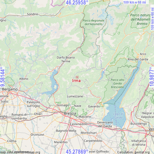
Irma GPS coordinates[2]
45° 46' 16.644" North, 10° 17' 4.452" East
| Map corner | latitude | longitude |
|---|---|---|
| Upper-left | 46.25958°, | 9.58144° |
| Center: | 45.77129°, | 10.28457° |
| Lower-right: | 45.27869°, | 10.9877° |
| Map W x H: | 109.1×109.1 km | = 67.8×67.8mi |
| max Lat: | 47.04031° ⇑15.5% North |
| Irma: | 45.77129° |
| min Lat: | ⇓84.5% South 35.50142° |
| min Long | Irma | max Long |
| 6.69888° | 10.28457° | 18.48682° |
| W 34.8%⇐ | ⇒65.2% E |
Elevation
Elevation of Irma is 814 m = 2671 ft, and this is 507.3 m = 1664 ft above average elevation for this country.
| Max E: |
2085 m = 6841 ft | 6.6% |
| Irma | 814 m 2671 ft | |
| Avg. | 306.7 m = 1006 ft | |
Min E: |
-4 m = -13 ft | 93.4% |
See also: Italy elevation on elevation.city.
Geographical zone
Irma is located in North temperate zone (between Tropic of Cancer and the Arctic Circle). Distance of this North polar circle is 2311.9 km =1436.5 mi to North.| Distance of | km | miles | from Irma |
|---|---|---|---|
| North Pole | 4917.8 | 3055.8 | to North |
| Arctic Circle | 2311.9 | 1436.5 | to North |
| Tropic Cancer | 2483.4 | 1543.1 | to South |
| Equator | 5089.3 | 3162.3 | to South |


Nearby cities:
15 places around Irma: (largest is in red/bold)
• Bovegno
2.5 km =1.6 mi,  333°
333°
• Briale
7.9 km =4.9 mi,  161°
161°
• Brozzo
7 km =4.3 mi,  216°
216°
• Collio
5.9 km =3.7 mi,  41°
41°
• Dosso-Ville
2.2 km =1.4 mi,  201°
201°
• Lodrino
5.8 km =3.6 mi,  185°
185°
• Marmentino
1.8 km =1.1 mi,  179°
179°
• Mura
7.9 km =4.9 mi,  145°
145°
• Pertica Alta
5.6 km =3.5 mi,  124°
124°
• Pertica Bassa
7.1 km =4.4 mi,  106°
106°
• Pezzaze
3.8 km =2.4 mi,  278°
278°
• San Colombano
8 km =5 mi,  55°
55°
• Stravignino
3.6 km =2.2 mi, 276°
• Tavernole
4.5 km =2.8 mi,  231°
231°
• Villa
5.9 km =3.7 mi, 184°
Sources, notices
• [Note1] Compared only with cities in Italy existing in our database
• [Src1] Map data: © OpenStreetMap contributors (CC-BY-SA)
• [Src2] Other city data from geonames.org with taken over terms of usage.
• [Src3] Geographical zone / Annual Mean Temperature by Robert A. Rohde @ Wikipedia
