Tavernole geodata
Tavernole (Lombardy) is a seat of a third-order administrative division; located in Italy in Europe/Rome (GMT+2) time zone. With population of 830 people, there are 7501 cities with bigger population in this country. Compared to other cities in Italy, 83.4% of cities are located further ↓South; 65.6% of cities are located further →East and 77.9% of cities have lower elevation than Tavernole. Note1
Administrative division(s):
- Level 1: Lombardy
- Level 2: Provincia di Brescia
- Level 3: Tavernole sul Mella


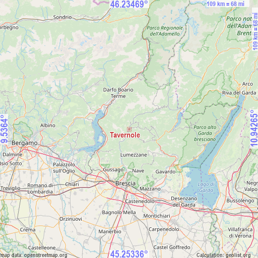
Tavernole GPS coordinates[2]
45° 44' 46.248" North, 10° 14' 22.272" East
| Map corner | latitude | longitude |
|---|---|---|
| Upper-left | 46.23469°, | 9.5364° |
| Center: | 45.74618°, | 10.23952° |
| Lower-right: | 45.25336°, | 10.94265° |
| Map W x H: | 109.1×109.1 km | = 67.8×67.8mi |
| max Lat: | 47.04031° ⇑16.6% North |
| Tavernole: | 45.74618° |
| min Lat: | ⇓83.4% South 35.50142° |
| min Long | Tavernole | max Long |
| 6.69888° | 10.23952° | 18.48682° |
| W 34.4%⇐ | ⇒65.6% E |
Elevation
Elevation of Tavernole is 491 m = 1611 ft, and this is 184.3 m = 605 ft above average elevation for this country.
| Max E: |
2085 m = 6841 ft | 22.1% |
| Tavernole | 491 m 1611 ft | |
| Avg. | 306.7 m = 1006 ft | |
Min E: |
-4 m = -13 ft | 77.9% |
See also: Italy elevation on elevation.city.
Geographical zone
Tavernole is located in North temperate zone (between Tropic of Cancer and the Arctic Circle). Distance of this North polar circle is 2314.7 km =1438.3 mi to North.| Distance of | km | miles | from Tavernole |
|---|---|---|---|
| North Pole | 4920.6 | 3057.5 | to North |
| Arctic Circle | 2314.7 | 1438.3 | to North |
| Tropic Cancer | 2480.6 | 1541.4 | to South |
| Equator | 5086.5 | 3160.6 | to South |


Nearby cities:
15 places around Tavernole: (largest is in red/bold)
• Bovegno
5.5 km =3.4 mi,  25°
25°
• Briale
7.7 km =4.8 mi,  128°
128°
• Brozzo
3 km =1.9 mi,  193°
193°
• Casto
8.5 km =5.3 mi, 131°
• Dosso-Ville
2.8 km =1.7 mi,  75°
75°
• Gardone Val Trompia
7.4 km =4.6 mi,  214°
214°
• Irma
4.5 km =2.8 mi,  51°
51°
• Lodrino
4.2 km =2.6 mi, 134°
• Magno
5.4 km =3.4 mi,  215°
215°
• Marcheno
4.8 km =3 mi,  203°
203°
• Marmentino
3.6 km =2.2 mi,  74°
74°
• Pertica Alta
8.1 km =5 mi,  92°
92°
• Pezzaze
3.4 km =2.1 mi,  355°
355°
• Stravignino
3.2 km =2 mi, 358°
• Villa
4.4 km =2.7 mi,  135°
135°
Sources, notices
• [Note1] Compared only with cities in Italy existing in our database
• [Src1] Map data: © OpenStreetMap contributors (CC-BY-SA)
• [Src2] Other city data from geonames.org with taken over terms of usage.
• [Src3] Geographical zone / Annual Mean Temperature by Robert A. Rohde @ Wikipedia
