Gavardo-Sopraponte geodata
Gavardo-Sopraponte (Lombardy) is a seat of a third-order administrative division; located in Italy in Europe/Rome (GMT+2) time zone. With population of 8,323 people, there are 1158 cities with bigger population in this country. Compared to other cities in Italy, 76.6% of cities are located further ↓South; 63.4% of cities are located further →East and 54.7% of cities have higher elevation than Gavardo-Sopraponte. Note1


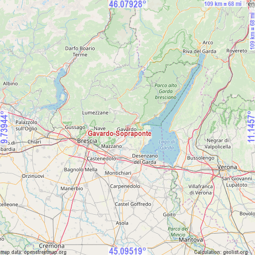
Gavardo-Sopraponte GPS coordinates[2]
45° 35' 21.804" North, 10° 26' 33.252" East
| Map corner | latitude | longitude |
|---|---|---|
| Upper-left | 46.07928°, | 9.73944° |
| Center: | 45.58939°, | 10.44257° |
| Lower-right: | 45.09519°, | 11.1457° |
| Map W x H: | 109.4×109.4 km | = 68×68mi |
| max Lat: | 47.04031° ⇑23.4% North |
| Gavardo-Sopraponte: | 45.58939° |
| min Lat: | ⇓76.6% South 35.50142° |
| min Long | Gavardo-Soprapo | max Long |
| 6.69888° | 10.44257° | 18.48682° |
| W 36.6%⇐ | ⇒63.4% E |
Elevation
Elevation of Gavardo-Sopraponte is 204 m = 669 ft, and this is 102.7 m = 337 ft below average elevation for this country.
| Max E: |
2085 m = 6841 ft | 54.7% |
| Avg. | 306.7 m = 1006 ft | |
| Gavardo-Sopraponte | 204 m = 669 ft | |
Min E: |
-4 m = -13 ft | 45.3% |
See also: Italy elevation on elevation.city.
Geographical zone
Gavardo-Sopraponte is located in North temperate zone (between Tropic of Cancer and the Arctic Circle). Distance of this North polar circle is 2332.1 km =1449.1 mi to North.| Distance of | km | miles | from Gavardo-Sopraponte |
|---|---|---|---|
| North Pole | 4938 | 3068.3 | to North |
| Arctic Circle | 2332.1 | 1449.1 | to North |
| Tropic Cancer | 2463.1 | 1530.5 | to South |
| Equator | 5069.1 | 3149.8 | to South |


Nearby cities:
15 places around Gavardo-Sopraponte: (largest is in red/bold)
• Calvagese della Riviera
5.6 km =3.5 mi,  177°
177°
• Case Nuove
4.4 km =2.7 mi,  301°
301°
• Castello
5.6 km =3.5 mi,  113°
113°
• Chiesa
3.2 km =2 mi,  152°
152°
• Cunettone-Villa
5.8 km =3.6 mi,  91°
91°
• Muscoline
3.3 km =2.1 mi, 153°
• Paitone
5.2 km =3.2 mi,  217°
217°
• Prevalle
4.5 km =2.8 mi,  200°
200°
• Puegnago sul Garda
5.8 km =3.6 mi,  115°
115°
• Roè
6 km =3.7 mi,  47°
47°
• Roè Volciano
4.4 km =2.7 mi, 54°
• San Biagio
1.6 km =1 mi, 94°
• San Giacomo
2.7 km =1.7 mi,  79°
79°
• Vallio Terme
4.2 km =2.6 mi, 302°
• Villanuova sul Clisi
1.4 km =0.9 mi,  35°
35°
Sources, notices
• [Note1] Compared only with cities in Italy existing in our database
• [Src1] Map data: © OpenStreetMap contributors (CC-BY-SA)
• [Src2] Other city data from geonames.org with taken over terms of usage.
• [Src3] Geographical zone / Annual Mean Temperature by Robert A. Rohde @ Wikipedia
