Bregano geodata
Bregano (Lombardy) is a seat of a third-order administrative division; located in Italy in Europe/Rome (GMT+2) time zone. With population of 836 people, there are 7467 cities with bigger population in this country. Compared to other cities in Italy, 86.9% of cities are located further ↓South; 85.6% of cities are located further →East and 62.7% of cities have lower elevation than Bregano. Note1


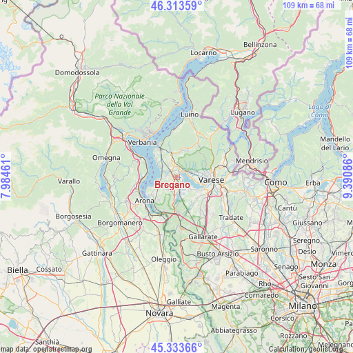
Bregano GPS coordinates[2]
45° 49' 32.808" North, 8° 41' 15.828" East
| Map corner | latitude | longitude |
|---|---|---|
| Upper-left | 46.31359°, | 7.98461° |
| Center: | 45.82578°, | 8.68773° |
| Lower-right: | 45.33366°, | 9.39086° |
| Map W x H: | 109×109 km | = 67.7×67.7mi |
| max Lat: | 47.04031° ⇑13.1% North |
| Bregano: | 45.82578° |
| min Lat: | ⇓86.9% South 35.50142° |
| min Long | Bregano | max Long |
| 6.69888° | 8.68773° | 18.48682° |
| W 14.4%⇐ | ⇒85.6% E |
Elevation
Elevation of Bregano is 320 m = 1050 ft, and this is 13.3 m = 44 ft above average elevation for this country.
| Max E: |
2085 m = 6841 ft | 37.3% |
| Bregano | 320 m 1050 ft | |
| Avg. | 306.7 m = 1006 ft | |
Min E: |
-4 m = -13 ft | 62.7% |
See also: Italy elevation on elevation.city.
Geographical zone
Bregano is located in North temperate zone (between Tropic of Cancer and the Arctic Circle). Distance of this North polar circle is 2305.8 km =1432.8 mi to North.| Distance of | km | miles | from Bregano |
|---|---|---|---|
| North Pole | 4911.7 | 3052 | to North |
| Arctic Circle | 2305.8 | 1432.8 | to North |
| Tropic Cancer | 2489.4 | 1546.8 | to South |
| Equator | 5095.3 | 3166.1 | to South |


Nearby cities:
15 places around Bregano: (largest is in red/bold)
• Barasso
5.6 km =3.5 mi,  73°
73°
• Bardello
1.3 km =0.8 mi,  31°
31°
• Besozzo
3.1 km =1.9 mi,  325°
325°
• Biandronno
2.2 km =1.4 mi,  131°
131°
• Brebbia
2.9 km =1.8 mi,  278°
278°
• Cadrezzate
4.5 km =2.8 mi,  229°
229°
• Caldana
5.1 km =3.2 mi,  4°
4°
• Cazzago Brabbia
4.9 km =3 mi, 132°
• Cocquio
4.1 km =2.5 mi, 0°
• Comerio
4.6 km =2.9 mi, 66°
• Gavirate
3.2 km =2 mi, 67°
• Malgesso
1 km =0.6 mi, 283°
• Osmate
4.8 km =3 mi,  211°
211°
• Ternate
4.4 km =2.7 mi,  168°
168°
• Travedona Monate
2.7 km =1.7 mi, 207°
Sources, notices
• [Note1] Compared only with cities in Italy existing in our database
• [Src1] Map data: © OpenStreetMap contributors (CC-BY-SA)
• [Src2] Other city data from geonames.org with taken over terms of usage.
• [Src3] Geographical zone / Annual Mean Temperature by Robert A. Rohde @ Wikipedia
