Isolabella geodata
Isolabella (Piedmont) is a seat of a third-order administrative division; located in Italy in Europe/Rome (GMT+2) time zone. With population of 382 people, there are 10350 cities with bigger population in this country. Compared to other cities in Italy, 58% of cities are located further ↓South; 94.6% of cities are located further →East and 54.6% of cities have lower elevation than Isolabella. Note1


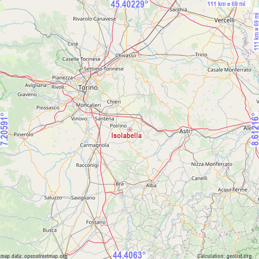
Isolabella GPS coordinates[2]
44° 54' 23.22" North, 7° 54' 32.508" East
| Map corner | latitude | longitude |
|---|---|---|
| Upper-left | 45.40229°, | 7.20591° |
| Center: | 44.90645°, | 7.90903° |
| Lower-right: | 44.4063°, | 8.61216° |
| Map W x H: | 110.7×110.7 km | = 68.8×68.8mi |
| max Lat: | 47.04031° ⇑42% North |
| Isolabella: | 44.90645° |
| min Lat: | ⇓58% South 35.50142° |
| min Long | Isolabella | max Long |
| 6.69888° | 7.90903° | 18.48682° |
| W 5.4%⇐ | ⇒94.6% E |
Elevation
Elevation of Isolabella is 263 m = 863 ft, and this is 43.7 m = 143 ft below average elevation for this country.
| Max E: |
2085 m = 6841 ft | 45.4% |
| Avg. | 306.7 m = 1006 ft | |
| Isolabella | 263 m = 863 ft | |
Min E: |
-4 m = -13 ft | 54.6% |
See also: Italy elevation on elevation.city.
Geographical zone
Isolabella is located in North temperate zone (between Tropic of Cancer and the Arctic Circle). Distance of this Northern Tropic circle is 2387.2 km =1483.3 mi to South.| Distance of | km | miles | from Isolabella |
|---|---|---|---|
| North Pole | 5013.9 | 3115.5 | to North |
| Arctic Circle | 2408 | 1496.3 | to North |
| Tropic Cancer | 2387.2 | 1483.3 | to South |
| Equator | 4993.1 | 3102.6 | to South |


Nearby cities:
15 places around Isolabella: (largest is in red/bold)
• Cantarana
9.3 km =5.8 mi,  92°
92°
• Cellarengo
5.5 km =3.4 mi,  148°
148°
• Dusino
5.4 km =3.4 mi,  66°
66°
• Favari-Avatanei
8.7 km =5.4 mi,  274°
274°
• Ferrere
7.5 km =4.7 mi,  116°
116°
• Marocchi
8.1 km =5 mi,  299°
299°
• Pessione
8.4 km =5.2 mi,  320°
320°
• Poirino
5.3 km =3.3 mi,  287°
287°
• Pralormo
5.2 km =3.2 mi,  184°
184°
• Riva Presso Chieri
9 km =5.6 mi,  341°
341°
• San Paolo Solbrito
6.9 km =4.3 mi,  44°
44°
• Stazione
7 km =4.3 mi,  27°
27°
• Valfenera
4.4 km =2.7 mi,  96°
96°
• Villafranca d'Asti
9.3 km =5.8 mi,  83°
83°
• Villanova d'Asti
4.6 km =2.9 mi, 28°
Sources, notices
• [Note1] Compared only with cities in Italy existing in our database
• [Src1] Map data: © OpenStreetMap contributors (CC-BY-SA)
• [Src2] Other city data from geonames.org with taken over terms of usage.
• [Src3] Geographical zone / Annual Mean Temperature by Robert A. Rohde @ Wikipedia
