Oncino geodata
Oncino (Piedmont) is a seat of a third-order administrative division; located in Italy in Europe/Rome (GMT+2) time zone. With population of 25 people, there are 11664 cities with bigger population in this country. Compared to other cities in Italy, 53.8% of cities are located further ↓South; 99.4% of cities are located further →East and 98.9% of cities have lower elevation than Oncino. Note1


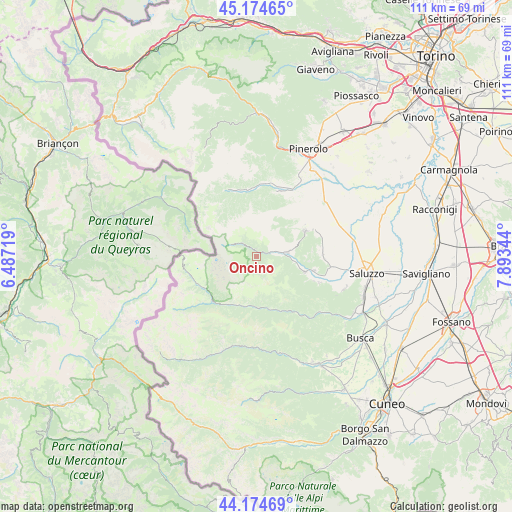
Oncino GPS coordinates[2]
44° 40' 36.588" North, 7° 11' 25.152" East
| Map corner | latitude | longitude |
|---|---|---|
| Upper-left | 45.17465°, | 6.48719° |
| Center: | 44.67683°, | 7.19032° |
| Lower-right: | 44.17469°, | 7.89344° |
| Map W x H: | 111.2×111.2 km | = 69.1×69.1mi |
| max Lat: | 47.04031° ⇑46.2% North |
| Oncino: | 44.67683° |
| min Lat: | ⇓53.8% South 35.50142° |
| min Long | Oncino | max Long |
| 6.69888° | 7.19032° | 18.48682° |
| W 0.6%⇐ | ⇒99.4% E |
Elevation
Elevation of Oncino is 1230 m = 4035 ft, and this is 923.3 m = 3029 ft above average elevation for this country.
| Max E: |
2085 m = 6841 ft | 1.1% |
| Oncino | 1230 m 4035 ft | |
| Avg. | 306.7 m = 1006 ft | |
Min E: |
-4 m = -13 ft | 98.9% |
See also: Italy elevation on elevation.city.
Geographical zone
Oncino is located in North temperate zone (between Tropic of Cancer and the Arctic Circle). Distance of this Northern Tropic circle is 2361.7 km =1467.5 mi to South.| Distance of | km | miles | from Oncino |
|---|---|---|---|
| North Pole | 5039.5 | 3131.4 | to North |
| Arctic Circle | 2433.6 | 1512.2 | to North |
| Tropic Cancer | 2361.7 | 1467.5 | to South |
| Equator | 4967.6 | 3086.7 | to South |


Nearby cities:
15 places around Oncino: (largest is in red/bold)
• Bagnolo Piemonte
13.5 km =8.4 mi,  46°
46°
• Barge
11.9 km =7.4 mi,  61°
61°
• Casteldelfino
13.5 km =8.4 mi,  224°
224°
• Crissolo
3.7 km =2.3 mi,  312°
312°
• Envie
14.4 km =8.9 mi,  87°
87°
• Frassino
13.4 km =8.3 mi,  149°
149°
• Gambasca
13.5 km =8.4 mi,  113°
113°
• Lusernetta
14.7 km =9.1 mi,  17°
17°
• Ostana
1.8 km =1.1 mi,  357°
357°
• Paesana
6.8 km =4.2 mi,  83°
83°
• Pontechianale
14.1 km =8.8 mi,  244°
244°
• Rifreddo
12.7 km =7.9 mi,  103°
103°
• Rorà
12.8 km =8 mi,  3°
3°
• Sampeyre
10.9 km =6.8 mi,  179°
179°
• Sanfront
11 km =6.8 mi, 107°
Sources, notices
• [Note1] Compared only with cities in Italy existing in our database
• [Src1] Map data: © OpenStreetMap contributors (CC-BY-SA)
• [Src2] Other city data from geonames.org with taken over terms of usage.
• [Src3] Geographical zone / Annual Mean Temperature by Robert A. Rohde @ Wikipedia
