Lusernetta geodata
Lusernetta (Piedmont) is a seat of a third-order administrative division; located in Italy in Europe/Rome (GMT+2) time zone. With population of 287 people, there are 10725 cities with bigger population in this country. Compared to other cities in Italy, 56.2% of cities are located further ↓South; 99.2% of cities are located further →East and 78.7% of cities have lower elevation than Lusernetta. Note1


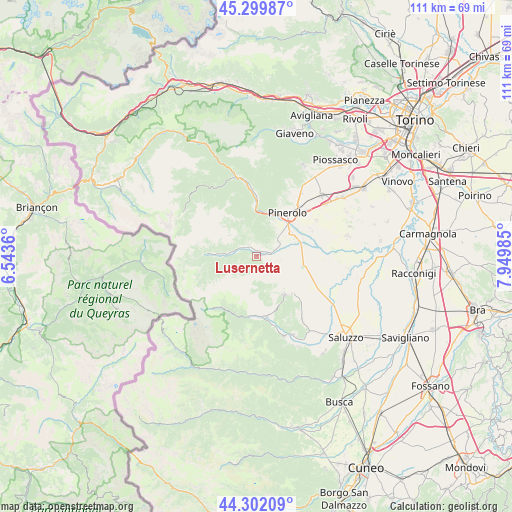
Lusernetta GPS coordinates[2]
44° 48' 11.304" North, 7° 14' 48.192" East
| Map corner | latitude | longitude |
|---|---|---|
| Upper-left | 45.29987°, | 6.5436° |
| Center: | 44.80314°, | 7.24672° |
| Lower-right: | 44.30209°, | 7.94985° |
| Map W x H: | 110.9×110.9 km | = 68.9×68.9mi |
| max Lat: | 47.04031° ⇑43.8% North |
| Lusernetta: | 44.80314° |
| min Lat: | ⇓56.2% South 35.50142° |
| min Long | Lusernetta | max Long |
| 6.69888° | 7.24672° | 18.48682° |
| W 0.8%⇐ | ⇒99.2% E |
Elevation
Elevation of Lusernetta is 502 m = 1647 ft, and this is 195.3 m = 641 ft above average elevation for this country.
| Max E: |
2085 m = 6841 ft | 21.3% |
| Lusernetta | 502 m 1647 ft | |
| Avg. | 306.7 m = 1006 ft | |
Min E: |
-4 m = -13 ft | 78.7% |
See also: Italy elevation on elevation.city.
Geographical zone
Lusernetta is located in North temperate zone (between Tropic of Cancer and the Arctic Circle). Distance of this Northern Tropic circle is 2375.7 km =1476.2 mi to South.| Distance of | km | miles | from Lusernetta |
|---|---|---|---|
| North Pole | 5025.4 | 3122.6 | to North |
| Arctic Circle | 2419.5 | 1503.4 | to North |
| Tropic Cancer | 2375.7 | 1476.2 | to South |
| Equator | 4981.6 | 3095.4 | to South |


Nearby cities:
15 places around Lusernetta: (largest is in red/bold)
• Airali
1.6 km =1 mi,  14°
14°
• Angrogna
4.8 km =3 mi,  338°
338°
• Bagnolo Piemonte
7.1 km =4.4 mi,  131°
131°
• Bibiana
3.3 km =2.1 mi,  98°
98°
• Bricherasio
5 km =3.1 mi,  63°
63°
• Campiglione
6.1 km =3.8 mi,  90°
90°
• Luserna
0.5 km =0.3 mi,  351°
351°
• Miradolo
9.1 km =5.7 mi,  29°
29°
• Osasco
9.2 km =5.7 mi, 55°
• Porte
9.5 km =5.9 mi, 11°
• Prarostino
7.2 km =4.5 mi, 13°
• Rorà
4 km =2.5 mi,  251°
251°
• San Secondo di Pinerolo
8.1 km =5 mi, 30°
• Torre Pellice
3.1 km =1.9 mi,  310°
310°
• Villar Pellice
6.9 km =4.3 mi,  275°
275°
Sources, notices
• [Note1] Compared only with cities in Italy existing in our database
• [Src1] Map data: © OpenStreetMap contributors (CC-BY-SA)
• [Src2] Other city data from geonames.org with taken over terms of usage.
• [Src3] Geographical zone / Annual Mean Temperature by Robert A. Rohde @ Wikipedia
