Imer geodata
Imer (Trentino-Alto Adige) is a seat of a third-order administrative division; located in Italy in Europe/Rome (GMT+2) time zone. With population of 1,114 people, there are 6243 cities with bigger population in this country. Compared to other cities in Italy, 94.9% of cities are located further ↓South; 53% of cities are located further ←West and 86.9% of cities have lower elevation than Imer. Note1
Administrative division(s):
- Level 1: Trentino-Alto Adige
- Level 2: Provincia autonoma di Trento
- Level 3: Imer


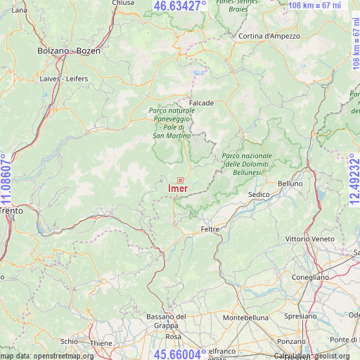
Imer GPS coordinates[2]
46° 8' 57.516" North, 11° 47' 21.084" East
| Map corner | latitude | longitude |
|---|---|---|
| Upper-left | 46.63427°, | 11.08607° |
| Center: | 46.14931°, | 11.78919° |
| Lower-right: | 45.66004°, | 12.49232° |
| Map W x H: | 108.3×108.3 km | = 67.3×67.3mi |
| max Lat: | 47.04031° ⇑5.1% North |
| Imer: | 46.14931° |
| min Lat: | ⇓94.9% South 35.50142° |
| min Long | Imer | max Long |
| 6.69888° | 11.78919° | 18.48682° |
| W 53%⇐ | ⇒47% E |
Elevation
Elevation of Imer is 649 m = 2129 ft, and this is 342.3 m = 1123 ft above average elevation for this country.
| Max E: |
2085 m = 6841 ft | 13.1% |
| Imer | 649 m 2129 ft | |
| Avg. | 306.7 m = 1006 ft | |
Min E: |
-4 m = -13 ft | 86.9% |
See also: Italy elevation on elevation.city.
Geographical zone
Imer is located in North temperate zone (between Tropic of Cancer and the Arctic Circle). Distance of this North polar circle is 2269.9 km =1410.5 mi to North.| Distance of | km | miles | from Imer |
|---|---|---|---|
| North Pole | 4875.7 | 3029.6 | to North |
| Arctic Circle | 2269.9 | 1410.5 | to North |
| Tropic Cancer | 2525.4 | 1569.2 | to South |
| Equator | 5131.3 | 3188.4 | to South |


Nearby cities:
15 places around Imer: (largest is in red/bold)
• Canal San Bovo
4.6 km =2.9 mi,  280°
280°
• Facen-Travagola
14.5 km =9 mi,  156°
156°
• Fiera di Primiero
4.3 km =2.7 mi,  45°
45°
• Fonzaso
14.8 km =9.2 mi,  177°
177°
• Gosaldo
15.1 km =9.4 mi,  57°
57°
• Lamon
11.8 km =7.3 mi,  194°
194°
• Mezzano
1.6 km =1 mi,  71°
71°
• Pedavena
14.2 km =8.8 mi,  149°
149°
• Sagron Mis
12.9 km =8 mi, 66°
• Servo
10.1 km =6.3 mi, 181°
• Siror
5.4 km =3.4 mi,  37°
37°
• Sovramonte
10.1 km =6.3 mi, 181°
• Tonadico
5.2 km =3.2 mi, 47°
• Transacqua
4.3 km =2.7 mi, 51°
• Villabruna-Umin
14.8 km =9.2 mi,  134°
134°
Sources, notices
• [Note1] Compared only with cities in Italy existing in our database
• [Src1] Map data: © OpenStreetMap contributors (CC-BY-SA)
• [Src2] Other city data from geonames.org with taken over terms of usage.
• [Src3] Geographical zone / Annual Mean Temperature by Robert A. Rohde @ Wikipedia
