Lamon geodata
Lamon (Veneto) is a seat of a third-order administrative division; located in Italy in Europe/Rome (GMT+2) time zone. With population of 1,779 people, there are 4519 cities with bigger population in this country. Compared to other cities in Italy, 93% of cities are located further ↓South; 52.5% of cities are located further ←West and 84.1% of cities have lower elevation than Lamon. Note1


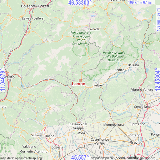
Lamon GPS coordinates[2]
46° 2' 49.812" North, 11° 44' 59.676" East
| Map corner | latitude | longitude |
|---|---|---|
| Upper-left | 46.53303°, | 11.04679° |
| Center: | 46.04717°, | 11.74991° |
| Lower-right: | 45.557°, | 12.45304° |
| Map W x H: | 108.5×108.5 km | = 67.4×67.4mi |
| max Lat: | 47.04031° ⇑7% North |
| Lamon: | 46.04717° |
| min Lat: | ⇓93% South 35.50142° |
| min Long | Lamon | max Long |
| 6.69888° | 11.74991° | 18.48682° |
| W 52.5%⇐ | ⇒47.5% E |
Elevation
Elevation of Lamon is 594 m = 1949 ft, and this is 287.3 m = 943 ft above average elevation for this country.
| Max E: |
2085 m = 6841 ft | 15.9% |
| Lamon | 594 m 1949 ft | |
| Avg. | 306.7 m = 1006 ft | |
Min E: |
-4 m = -13 ft | 84.1% |
See also: Italy elevation on elevation.city.
Geographical zone
Lamon is located in North temperate zone (between Tropic of Cancer and the Arctic Circle). Distance of this North polar circle is 2281.2 km =1417.5 mi to North.| Distance of | km | miles | from Lamon |
|---|---|---|---|
| North Pole | 4887.1 | 3036.7 | to North |
| Arctic Circle | 2281.2 | 1417.5 | to North |
| Tropic Cancer | 2514 | 1562.1 | to South |
| Equator | 5120 | 3181.4 | to South |


Nearby cities:
15 places around Lamon: (largest is in red/bold)
• Arsiè
7.3 km =4.5 mi,  175°
175°
• Arten
7.5 km =4.7 mi,  125°
125°
• Castello Tesino
9.2 km =5.7 mi,  281°
281°
• Cinte Tesino
10.5 km =6.5 mi, 276°
• Facen-Travagola
9 km =5.6 mi,  102°
102°
• Feltre
12 km =7.5 mi, 104°
• Fonzaso
5.1 km =3.2 mi, 132°
• Grigno
9.5 km =5.9 mi,  248°
248°
• Imer
11.8 km =7.3 mi,  14°
14°
• Pedavena
10.3 km =6.4 mi,  94°
94°
• Pieve Tesino
11 km =6.8 mi, 282°
• Seren del Grappa
10 km =6.2 mi,  124°
124°
• Servo
3.1 km =1.9 mi,  66°
66°
• Sovramonte
3.1 km =1.9 mi, 65°
• Tezze
8.8 km =5.5 mi,  225°
225°
Sources, notices
• [Note1] Compared only with cities in Italy existing in our database
• [Src1] Map data: © OpenStreetMap contributors (CC-BY-SA)
• [Src2] Other city data from geonames.org with taken over terms of usage.
• [Src3] Geographical zone / Annual Mean Temperature by Robert A. Rohde @ Wikipedia
