Lombriasco geodata
Lombriasco (Piedmont) is a seat of a third-order administrative division; located in Italy in Europe/Rome (GMT+2) time zone. With population of 1,007 people, there are 6639 cities with bigger population in this country. Compared to other cities in Italy, 56.9% of cities are located further ↓South; 96.8% of cities are located further →East and 51.4% of cities have lower elevation than Lombriasco. Note1


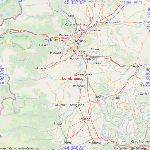
Lombriasco GPS coordinates[2]
44° 50' 27.384" North, 7° 38' 9.348" East
| Map corner | latitude | longitude |
|---|---|---|
| Upper-left | 45.33735°, | 6.93281° |
| Center: | 44.84094°, | 7.63593° |
| Lower-right: | 44.34022°, | 8.33906° |
| Map W x H: | 110.9×110.9 km | = 68.9×68.9mi |
| max Lat: | 47.04031° ⇑43.1% North |
| Lombriasco: | 44.84094° |
| min Lat: | ⇓56.9% South 35.50142° |
| min Long | Lombriasco | max Long |
| 6.69888° | 7.63593° | 18.48682° |
| W 3.2%⇐ | ⇒96.8% E |
Elevation
Elevation of Lombriasco is 243 m = 797 ft, and this is 63.7 m = 209 ft below average elevation for this country.
| Max E: |
2085 m = 6841 ft | 48.6% |
| Avg. | 306.7 m = 1006 ft | |
| Lombriasco | 243 m = 797 ft | |
Min E: |
-4 m = -13 ft | 51.4% |
See also: Italy elevation on elevation.city.
Geographical zone
Lombriasco is located in North temperate zone (between Tropic of Cancer and the Arctic Circle). Distance of this Northern Tropic circle is 2379.9 km =1478.8 mi to South.| Distance of | km | miles | from Lombriasco |
|---|---|---|---|
| North Pole | 5021.2 | 3120 | to North |
| Arctic Circle | 2415.3 | 1500.8 | to North |
| Tropic Cancer | 2379.9 | 1478.8 | to South |
| Equator | 4985.8 | 3098 | to South |


Nearby cities:
15 places around Lombriasco: (largest is in red/bold)
• Carignano
7.8 km =4.8 mi,  21°
21°
• Carmagnola
6.7 km =4.2 mi,  81°
81°
• Casalgrasso
2.7 km =1.7 mi,  198°
198°
• Castagnole Piemonte
8.4 km =5.2 mi,  319°
319°
• Cavalleri-Fumeri
8.5 km =5.3 mi,  96°
96°
• Faule
5.6 km =3.5 mi,  226°
226°
• Murello
10.3 km =6.4 mi, 195°
• Osasio
4 km =2.5 mi,  327°
327°
• Pancalieri
4 km =2.5 mi,  258°
258°
• Piobesi Torinese
8.4 km =5.2 mi,  190°
190°
• Piobesi Torinese
10.4 km =6.5 mi,  348°
348°
• Polonghera
5.3 km =3.3 mi,  216°
216°
• Racconigi
9 km =5.6 mi,  157°
157°
• San Michele e Grato
5.5 km =3.4 mi,  69°
69°
• Virle Piemonte
5.8 km =3.6 mi,  296°
296°
Sources, notices
• [Note1] Compared only with cities in Italy existing in our database
• [Src1] Map data: © OpenStreetMap contributors (CC-BY-SA)
• [Src2] Other city data from geonames.org with taken over terms of usage.
• [Src3] Geographical zone / Annual Mean Temperature by Robert A. Rohde @ Wikipedia
