Maugeri geodata
Maugeri (Sicily) is a populated place; located in Italy in Europe/Rome (GMT+2) time zone. With population of 2,285 people, there are 3777 cities with bigger population in this country. Compared to other cities in Italy, 98.6% of cities are located further ↑North; 88.2% of cities are located further ←West and 65.5% of cities have lower elevation than Maugeri. Note1


Maugeri GPS coordinates[2]
37° 35' 9.888" North, 15° 7' 4.26" East
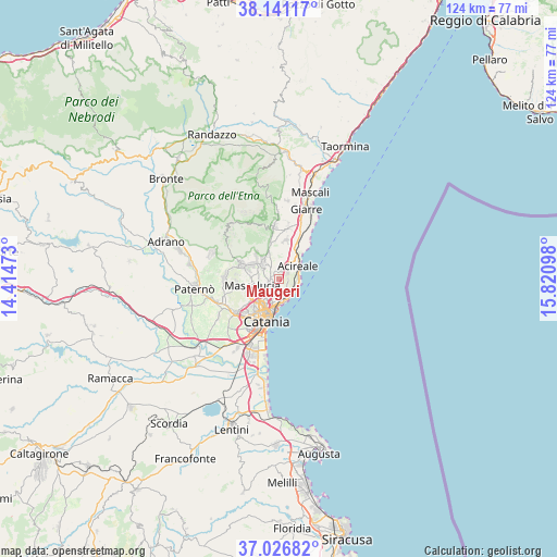
| Map corner | latitude | longitude |
|---|---|---|
| Upper-left | 38.14117°, | 14.41473° |
| Center: | 37.58608°, | 15.11785° |
| Lower-right: | 37.02682°, | 15.82098° |
| Map W x H: | 123.9×123.9 km | = 77×77mi |
| max Lat: | 47.04031° ⇑98.6% North |
| Maugeri: | 37.58608° |
| min Lat: | ⇓1.4% South 35.50142° |
| min Long | Maugeri | max Long |
| 6.69888° | 15.11785° | 18.48682° |
| W 88.2%⇐ | ⇒11.8% E |
Elevation
Elevation of Maugeri is 348 m = 1142 ft, and this is 41.3 m = 135 ft above average elevation for this country.
| Max E: |
2085 m = 6841 ft | 34.5% |
| Maugeri | 348 m 1142 ft | |
| Avg. | 306.7 m = 1006 ft | |
Min E: |
-4 m = -13 ft | 65.5% |
See also: Italy elevation on elevation.city.
Geographical zone
Maugeri is located in North temperate zone (between Tropic of Cancer and the Arctic Circle). Distance of this Northern Tropic circle is 1573.3 km =977.6 mi to South.| Distance of | km | miles | from Maugeri |
|---|---|---|---|
| North Pole | 5827.9 | 3621.3 | to North |
| Arctic Circle | 3222 | 2002.1 | to North |
| Tropic Cancer | 1573.3 | 977.6 | to South |
| Equator | 4179.2 | 2596.8 | to South |


Nearby cities:
15 places around Maugeri: (largest is in red/bold)
• Aci Bonaccorsi
1.5 km =0.9 mi,  320°
320°
• Aci Castello
4.2 km =2.6 mi,  144°
144°
• Aci Catena
3.1 km =1.9 mi,  43°
43°
• Aci Sant'Antonio
2.1 km =1.3 mi,  12°
12°
• Aci Trezza
4.6 km =2.9 mi,  122°
122°
• Acitrezza
4.7 km =2.9 mi,  128°
128°
• Carrubazza-Motta
3.8 km =2.4 mi,  193°
193°
• San Giovanni la Punta
2.4 km =1.5 mi,  244°
244°
• San Gregorio di Catania
2.1 km =1.3 mi,  195°
195°
• Sant'Agata Li Battiati
4.6 km =2.9 mi,  226°
226°
• Santa Maria la Stella
4.2 km =2.6 mi,  3°
3°
• Tremestieri Etneo
4.2 km =2.6 mi, 235°
• Valverde
1.2 km =0.7 mi,  151°
151°
• Vambolieri
4 km =2.5 mi,  109°
109°
• Viagrande
3.2 km =2 mi,  326°
326°
Sources, notices
• [Note1] Compared only with cities in Italy existing in our database
• [Src1] Map data: © OpenStreetMap contributors (CC-BY-SA)
• [Src2] Other city data from geonames.org with taken over terms of usage.
• [Src3] Geographical zone / Annual Mean Temperature by Robert A. Rohde @ Wikipedia
