Fonte Umano-San Martino Alta geodata
Fonte Umano-San Martino Alta (Abruzzo) is a populated place; located in Italy in Europe/Rome (GMT+2) time zone. With population of 1,743 people, there are 4585 cities with bigger population in this country. Compared to other cities in Italy, 66.2% of cities are located further ↑North; 79.1% of cities are located further ←West and 67.3% of cities have higher elevation than Fonte Umano-San Martino Alta. Note1
Administrative division(s):
- Level 1: Abruzzo
- Level 2: Provincia di Pescara
- Level 3: Città Sant'Angelo
Current local time in Fonte Umano-San Martino Alta:
10:57 PM, WednesdayDifference from your time zone: hours


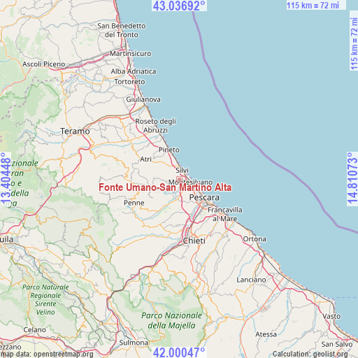
Fonte Umano-San Martino Alta GPS coordinates[2]
42° 31' 15.024" North, 14° 6' 27.36" East
| Map corner | latitude | longitude |
|---|---|---|
| Upper-left | 43.03692°, | 13.40448° |
| Center: | 42.52084°, | 14.1076° |
| Lower-right: | 42.00047°, | 14.81073° |
| Map W x H: | 115.2×115.2 km | = 71.6×71.6mi |
| max Lat: | 47.04031° ⇑66.2% North |
| Fonte Umano-San Martino Alta: | 42.52084° |
| min Lat: | ⇓33.8% South 35.50142° |
| min Long | Fonte Umano-San | max Long |
| 6.69888° | 14.1076° | 18.48682° |
| W 79.1%⇐ | ⇒20.9% E |
Elevation
Elevation of Fonte Umano-San Martino Alta is 114 m = 374 ft, and this is 192.7 m = 632 ft below average elevation for this country.
| Max E: |
2085 m = 6841 ft | 67.3% |
| Avg. | 306.7 m = 1006 ft | |
| Fonte Umano-San Martino Alta | 114 m = 374 ft | |
Min E: |
-4 m = -13 ft | 32.7% |
See also: Italy elevation on elevation.city.
Geographical zone
Fonte Umano-San Martino Alta is located in North temperate zone (between Tropic of Cancer and the Arctic Circle). Distance of this Northern Tropic circle is 2122 km =1318.5 mi to South.| Distance of | km | miles | from Fonte Umano-San Martino Alta |
|---|---|---|---|
| North Pole | 5279.2 | 3280.3 | to North |
| Arctic Circle | 2673.3 | 1661.1 | to North |
| Tropic Cancer | 2122 | 1318.5 | to South |
| Equator | 4727.9 | 2937.8 | to South |


Nearby cities:
15 places around Fonte Umano-San Martino Alta: (largest is in red/bold)
• Cappelle sul Tavo
4.9 km =3 mi,  180°
180°
• Caprara d'Abruzzo
9.8 km =6.1 mi, 178°
• Città Sant'Angelo
3.8 km =2.4 mi,  256°
256°
• Collecorvino
10.1 km =6.3 mi,  228°
228°
• Congiunti
5.8 km =3.6 mi,  198°
198°
• Montesilvano Colle
4.5 km =2.8 mi,  137°
137°
• Montesilvano Marina
3.2 km =2 mi,  108°
108°
• Mutignano
9.6 km =6 mi,  321°
321°
• Pianacce
4.2 km =2.6 mi,  337°
337°
• San Martino Bassa
1.9 km =1.2 mi,  98°
98°
• Santa Maria a Valle
8.3 km =5.2 mi, 343°
• Silvi
3.3 km =2.1 mi,  14°
14°
• Silvi Paese
5 km =3.1 mi, 341°
• Spoltore
7.8 km =4.8 mi,  160°
160°
• Villa Raspa
9.6 km =6 mi, 139°
Sources, notices
• [Note1] Compared only with cities in Italy existing in our database
• [Src1] Map data: © OpenStreetMap contributors (CC-BY-SA)
• [Src2] Other city data from geonames.org with taken over terms of usage.
• [Src3] Geographical zone / Annual Mean Temperature by Robert A. Rohde @ Wikipedia
