Pulce geodata
Pulce (Emilia-Romagna) is a populated place; located in Italy in Europe/Rome (GMT+2) time zone. With population of 1,556 people, there are 4988 cities with bigger population in this country. Compared to other cities in Italy, 50.3% of cities are located further ↓South; 51.7% of cities are located further →East and 72% of cities have higher elevation than Pulce. Note1


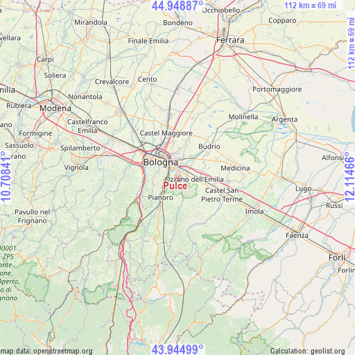
Pulce GPS coordinates[2]
44° 26' 56.724" North, 11° 24' 41.508" East
| Map corner | latitude | longitude |
|---|---|---|
| Upper-left | 44.94887°, | 10.70841° |
| Center: | 44.44909°, | 11.41153° |
| Lower-right: | 43.94499°, | 12.11466° |
| Map W x H: | 111.6×111.6 km | = 69.3×69.3mi |
| max Lat: | 47.04031° ⇑49.7% North |
| Pulce: | 44.44909° |
| min Lat: | ⇓50.3% South 35.50142° |
| min Long | Pulce | max Long |
| 6.69888° | 11.41153° | 18.48682° |
| W 48.3%⇐ | ⇒51.7% E |
Elevation
Elevation of Pulce is 88 m = 289 ft, and this is 218.7 m = 718 ft below average elevation for this country.
| Max E: |
2085 m = 6841 ft | 72% |
| Avg. | 306.7 m = 1006 ft | |
| Pulce | 88 m = 289 ft | |
Min E: |
-4 m = -13 ft | 28% |
See also: Italy elevation on elevation.city.
Geographical zone
Pulce is located in North temperate zone (between Tropic of Cancer and the Arctic Circle). Distance of this Northern Tropic circle is 2336.4 km =1451.8 mi to South.| Distance of | km | miles | from Pulce |
|---|---|---|---|
| North Pole | 5064.8 | 3147.1 | to North |
| Arctic Circle | 2458.9 | 1527.9 | to North |
| Tropic Cancer | 2336.4 | 1451.8 | to South |
| Equator | 4942.3 | 3071 | to South |


Nearby cities:
15 places around Pulce: (largest is in red/bold)
• Bologna
7.6 km =4.7 mi,  310°
310°
• Castenaso
8.5 km =5.3 mi,  32°
32°
• Maggio
7.2 km =4.5 mi,  101°
101°
• Martiri di Pizzocalvo
1.1 km =0.7 mi,  274°
274°
• Mercatale
6.6 km =4.1 mi,  166°
166°
• Osteria Grande
9.1 km =5.7 mi, 104°
• Ozzano dell'Emilia
5.1 km =3.2 mi, 96°
• Pianoro
8.6 km =5.3 mi,  219°
219°
• Ponte Rizzoli
8 km =5 mi,  77°
77°
• Ponticella
2.7 km =1.7 mi,  282°
282°
• Quarto Inferiore
9.1 km =5.7 mi,  2°
2°
• Rastignano-Carteria di Sesto
4.6 km =2.9 mi,  251°
251°
• San Lazzaro
2.4 km =1.5 mi,  354°
354°
• Trappolone
3.9 km =2.4 mi, 267°
• Villanova
5.9 km =3.7 mi,  15°
15°
Sources, notices
• [Note1] Compared only with cities in Italy existing in our database
• [Src1] Map data: © OpenStreetMap contributors (CC-BY-SA)
• [Src2] Other city data from geonames.org with taken over terms of usage.
• [Src3] Geographical zone / Annual Mean Temperature by Robert A. Rohde @ Wikipedia
