Bosco geodata
Bosco (Emilia-Romagna) is a populated place; located in Italy in Europe/Rome (GMT+2) time zone. With population of 706 people, there are 8260 cities with bigger population in this country. Compared to other cities in Italy, 52.9% of cities are located further ↓South; 61.2% of cities are located further →East and 72% of cities have higher elevation than Bosco. Note1
Administrative division(s):
- Level 1: Emilia-Romagna
- Level 2: Provincia di Reggio Emilia
- Level 3: Scandiano


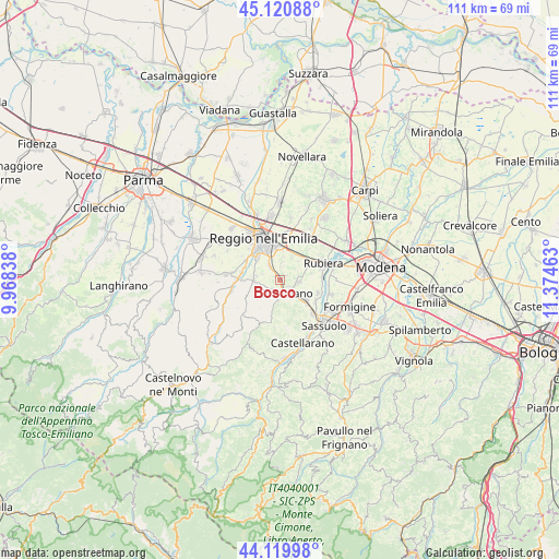
Bosco GPS coordinates[2]
44° 37' 21.324" North, 10° 40' 17.4" East
| Map corner | latitude | longitude |
|---|---|---|
| Upper-left | 45.12088°, | 9.96838° |
| Center: | 44.62259°, | 10.6715° |
| Lower-right: | 44.11998°, | 11.37463° |
| Map W x H: | 111.3×111.3 km | = 69.2×69.2mi |
| max Lat: | 47.04031° ⇑47.1% North |
| Bosco: | 44.62259° |
| min Lat: | ⇓52.9% South 35.50142° |
| min Long | Bosco | max Long |
| 6.69888° | 10.6715° | 18.48682° |
| W 38.8%⇐ | ⇒61.2% E |
Elevation
Elevation of Bosco is 88 m = 289 ft, and this is 218.7 m = 718 ft below average elevation for this country.
| Max E: |
2085 m = 6841 ft | 72% |
| Avg. | 306.7 m = 1006 ft | |
| Bosco | 88 m = 289 ft | |
Min E: |
-4 m = -13 ft | 28% |
See also: Italy elevation on elevation.city.
Geographical zone
Bosco is located in North temperate zone (between Tropic of Cancer and the Arctic Circle). Distance of this Northern Tropic circle is 2355.6 km =1463.7 mi to South.| Distance of | km | miles | from Bosco |
|---|---|---|---|
| North Pole | 5045.5 | 3135.1 | to North |
| Arctic Circle | 2439.6 | 1515.9 | to North |
| Tropic Cancer | 2355.6 | 1463.7 | to South |
| Equator | 4961.6 | 3083 | to South |


Nearby cities:
15 places around Bosco: (largest is in red/bold)
• Albinea
4.9 km =3 mi,  277°
277°
• Arceto
4.2 km =2.6 mi,  97°
97°
• Bagno
7.8 km =4.8 mi,  62°
62°
• Borzano
3.5 km =2.2 mi,  232°
232°
• Ca' de' Caroli
3.9 km =2.4 mi,  176°
176°
• Casalgrande
6.6 km =4.1 mi,  129°
129°
• Corticella
6.5 km =4 mi,  78°
78°
• Fellegara
2.4 km =1.5 mi,  123°
123°
• Fogliano
3.5 km =2.2 mi,  322°
322°
• Forche
7.9 km =4.9 mi, 281°
• Gavasseto
3.5 km =2.2 mi,  5°
5°
• Pratissolo
2.1 km =1.3 mi,  174°
174°
• Salvaterra
8.1 km =5 mi,  108°
108°
• Scandiano
3.3 km =2.1 mi,  144°
144°
• Ventoso
4.2 km =2.6 mi,  162°
162°
Sources, notices
• [Note1] Compared only with cities in Italy existing in our database
• [Src1] Map data: © OpenStreetMap contributors (CC-BY-SA)
• [Src2] Other city data from geonames.org with taken over terms of usage.
• [Src3] Geographical zone / Annual Mean Temperature by Robert A. Rohde @ Wikipedia
