Fogliano geodata
Fogliano (Emilia-Romagna) is a populated place; located in Italy in Europe/Rome (GMT+2) time zone. With population of 2,607 people, there are 3409 cities with bigger population in this country. Compared to other cities in Italy, 53.3% of cities are located further ↓South; 61.4% of cities are located further →East and 75.6% of cities have higher elevation than Fogliano. Note1
Administrative division(s):
- Level 1: Emilia-Romagna
- Level 2: Provincia di Reggio Emilia
- Level 3: Reggio nell'Emilia


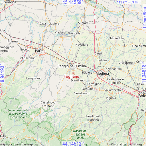
Fogliano GPS coordinates[2]
44° 38' 51.036" North, 10° 38' 42.18" East
| Map corner | latitude | longitude |
|---|---|---|
| Upper-left | 45.14559°, | 9.94193° |
| Center: | 44.64751°, | 10.64505° |
| Lower-right: | 44.14512°, | 11.34818° |
| Map W x H: | 111.2×111.2 km | = 69.1×69.1mi |
| max Lat: | 47.04031° ⇑46.7% North |
| Fogliano: | 44.64751° |
| min Lat: | ⇓53.3% South 35.50142° |
| min Long | Fogliano | max Long |
| 6.69888° | 10.64505° | 18.48682° |
| W 38.6%⇐ | ⇒61.4% E |
Elevation
Elevation of Fogliano is 71 m = 233 ft, and this is 235.7 m = 773 ft below average elevation for this country.
| Max E: |
2085 m = 6841 ft | 75.6% |
| Avg. | 306.7 m = 1006 ft | |
| Fogliano | 71 m = 233 ft | |
Min E: |
-4 m = -13 ft | 24.4% |
See also: Italy elevation on elevation.city.
Geographical zone
Fogliano is located in North temperate zone (between Tropic of Cancer and the Arctic Circle). Distance of this Northern Tropic circle is 2358.4 km =1465.4 mi to South.| Distance of | km | miles | from Fogliano |
|---|---|---|---|
| North Pole | 5042.7 | 3133.4 | to North |
| Arctic Circle | 2436.8 | 1514.2 | to North |
| Tropic Cancer | 2358.4 | 1465.4 | to South |
| Equator | 4964.3 | 3084.7 | to South |


Nearby cities:
15 places around Fogliano: (largest is in red/bold)
• Albinea
3.5 km =2.2 mi,  232°
232°
• Arceto
7.1 km =4.4 mi,  117°
117°
• Borzano
4.9 km =3 mi,  187°
187°
• Bosco
3.5 km =2.2 mi,  142°
142°
• Ca' de' Caroli
7 km =4.3 mi,  160°
160°
• Corticella
8.6 km =5.3 mi,  99°
99°
• Fellegara
5.8 km =3.6 mi, 135°
• Forche
5.8 km =3.6 mi,  257°
257°
• Gavasseto
2.6 km =1.6 mi,  73°
73°
• Montecavolo
8.3 km =5.2 mi, 258°
• Pratissolo
5.3 km =3.3 mi,  154°
154°
• Puianello
6.8 km =4.2 mi,  249°
249°
• Reggio nell'Emilia
5.7 km =3.5 mi,  349°
349°
• Scandiano
6.8 km =4.2 mi, 143°
• Ventoso
7.6 km =4.7 mi, 153°
Sources, notices
• [Note1] Compared only with cities in Italy existing in our database
• [Src1] Map data: © OpenStreetMap contributors (CC-BY-SA)
• [Src2] Other city data from geonames.org with taken over terms of usage.
• [Src3] Geographical zone / Annual Mean Temperature by Robert A. Rohde @ Wikipedia
