San Vito-Cerreto geodata
San Vito-Cerreto (Tuscany) is a seat of a third-order administrative division; located in Italy in Europe/Rome (GMT+2) time zone. With population of 1,311 people, there are 5597 cities with bigger population in this country. Compared to other cities in Italy, 54.5% of cities are located further ↑North; 66.3% of cities are located further →East and 60.3% of cities have lower elevation than San Vito-Cerreto. Note1
Administrative division(s):
- Level 1: Tuscany
- Level 2: Provincia di Massa-Carrara
- Level 3: Montignoso


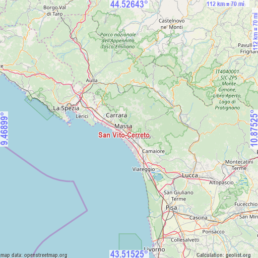
San Vito-Cerreto GPS coordinates[2]
44° 1' 22.8" North, 10° 10' 19.632" East
| Map corner | latitude | longitude |
|---|---|---|
| Upper-left | 44.52643°, | 9.46899° |
| Center: | 44.023°, | 10.17212° |
| Lower-right: | 43.51525°, | 10.87525° |
| Map W x H: | 112.4×112.4 km | = 69.8×69.8mi |
| max Lat: | 47.04031° ⇑54.5% North |
| San Vito-Cerreto: | 44.023° |
| min Lat: | ⇓45.5% South 35.50142° |
| min Long | San Vito-Cerret | max Long |
| 6.69888° | 10.17212° | 18.48682° |
| W 33.7%⇐ | ⇒66.3% E |
Elevation
Elevation of San Vito-Cerreto is 301 m = 988 ft, and this is 5.7 m = 19 ft below average elevation for this country.
| Max E: |
2085 m = 6841 ft | 39.7% |
| Avg. | 306.7 m = 1006 ft | |
| San Vito-Cerreto | 301 m = 988 ft | |
Min E: |
-4 m = -13 ft | 60.3% |
See also: Italy elevation on elevation.city.
Geographical zone
San Vito-Cerreto is located in North temperate zone (between Tropic of Cancer and the Arctic Circle). Distance of this Northern Tropic circle is 2289 km =1422.3 mi to South.| Distance of | km | miles | from San Vito-Cerreto |
|---|---|---|---|
| North Pole | 5112.2 | 3176.6 | to North |
| Arctic Circle | 2506.3 | 1557.3 | to North |
| Tropic Cancer | 2289 | 1422.3 | to South |
| Equator | 4894.9 | 3041.5 | to South |


Nearby cities:
15 places around San Vito-Cerreto: (largest is in red/bold)
• Bedizzano
7.3 km =4.5 mi,  328°
328°
• Capanne-Prato-Cinquale
3.1 km =1.9 mi,  203°
203°
• Carrara
8.6 km =5.3 mi,  316°
316°
• Casette
5.8 km =3.6 mi,  356°
356°
• Codena
7.7 km =4.8 mi, 322°
• Forno
6.6 km =4.1 mi,  3°
3°
• Forte dei Marmi
6.6 km =4.1 mi,  178°
178°
• Marina di Massa
5.6 km =3.5 mi,  247°
247°
• Massa
3 km =1.9 mi,  297°
297°
• Montignoso
0.1 km =0.1 mi,  17°
17°
• Pietrasanta
8.3 km =5.2 mi,  147°
147°
• Ripa-Pozzi-Querceta-Ponterosso
5.6 km =3.5 mi, 153°
• Seravezza
5.4 km =3.4 mi,  125°
125°
• Strettoia
4.1 km =2.5 mi,  155°
155°
• Torano
9.4 km =5.8 mi, 324°
Sources, notices
• [Note1] Compared only with cities in Italy existing in our database
• [Src1] Map data: © OpenStreetMap contributors (CC-BY-SA)
• [Src2] Other city data from geonames.org with taken over terms of usage.
• [Src3] Geographical zone / Annual Mean Temperature by Robert A. Rohde @ Wikipedia
