Rotta geodata
Rotta (Lombardy) is a populated place; located in Italy in Europe/Rome (GMT+2) time zone. With population of 1,278 people, there are 5704 cities with bigger population in this country. Compared to other cities in Italy, 64.1% of cities are located further ↓South; 78.9% of cities are located further →East and 77% of cities have higher elevation than Rotta. Note1
Administrative division(s):
- Level 1: Lombardy
- Level 2: Provincia di Pavia
- Level 3: Travacò Siccomario


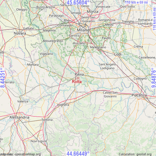
Rotta GPS coordinates[2]
45° 9' 44.712" North, 9° 8' 44.304" East
| Map corner | latitude | longitude |
|---|---|---|
| Upper-left | 45.65604°, | 8.44251° |
| Center: | 45.16242°, | 9.14564° |
| Lower-right: | 44.66449°, | 9.84876° |
| Map W x H: | 110.3×110.2 km | = 68.5×68.5mi |
| max Lat: | 47.04031° ⇑35.9% North |
| Rotta: | 45.16242° |
| min Lat: | ⇓64.1% South 35.50142° |
| min Long | Rotta | max Long |
| 6.69888° | 9.14564° | 18.48682° |
| W 21.1%⇐ | ⇒78.9% E |
Elevation
Elevation of Rotta is 64 m = 210 ft, and this is 242.7 m = 796 ft below average elevation for this country.
| Max E: |
2085 m = 6841 ft | 77% |
| Avg. | 306.7 m = 1006 ft | |
| Rotta | 64 m = 210 ft | |
Min E: |
-4 m = -13 ft | 23% |
See also: Italy elevation on elevation.city.
Geographical zone
Rotta is located in North temperate zone (between Tropic of Cancer and the Arctic Circle). Distance of this North polar circle is 2379.6 km =1478.6 mi to North.| Distance of | km | miles | from Rotta |
|---|---|---|---|
| North Pole | 4985.5 | 3097.8 | to North |
| Arctic Circle | 2379.6 | 1478.6 | to North |
| Tropic Cancer | 2415.7 | 1501 | to South |
| Equator | 5021.6 | 3120.3 | to South |


Nearby cities:
15 places around Rotta: (largest is in red/bold)
• Bivio Cava Manara
3 km =1.9 mi,  221°
221°
• Carbonara al Ticino
6.3 km =3.9 mi,  271°
271°
• Cascine Calderari
7.8 km =4.8 mi,  348°
348°
• Cava Manara
3.9 km =2.4 mi,  230°
230°
• Fossarmato
6.8 km =4.2 mi,  59°
59°
• Gallo-Tre Re-Mezzana Corti
4.5 km =2.8 mi,  204°
204°
• Madonna
2 km =1.2 mi,  235°
235°
• Mezzanino
6.3 km =3.9 mi,  131°
131°
• Pavia
3.5 km =2.2 mi,  17°
17°
• Rea
5.5 km =3.4 mi,  172°
172°
• San Martino Siccomario
0.4 km =0.2 mi,  285°
285°
• Sommo
5.7 km =3.5 mi, 234°
• Travacò Siccomario
1.8 km =1.1 mi,  143°
143°
• Valle Salimbene
7 km =4.3 mi,  81°
81°
• Verrua Po
6.6 km =4.1 mi,  159°
159°
Sources, notices
• [Note1] Compared only with cities in Italy existing in our database
• [Src1] Map data: © OpenStreetMap contributors (CC-BY-SA)
• [Src2] Other city data from geonames.org with taken over terms of usage.
• [Src3] Geographical zone / Annual Mean Temperature by Robert A. Rohde @ Wikipedia
