Fossarmato geodata
Fossarmato (Lombardy) is a populated place; located in Italy in Europe/Rome (GMT+2) time zone. With population of 543 people, there are 9518 cities with bigger population in this country. Compared to other cities in Italy, 64.8% of cities are located further ↓South; 77.7% of cities are located further →East and 73.8% of cities have higher elevation than Fossarmato. Note1


Fossarmato GPS coordinates[2]
45° 11' 37.788" North, 9° 13' 11.856" East
| Map corner | latitude | longitude |
|---|---|---|
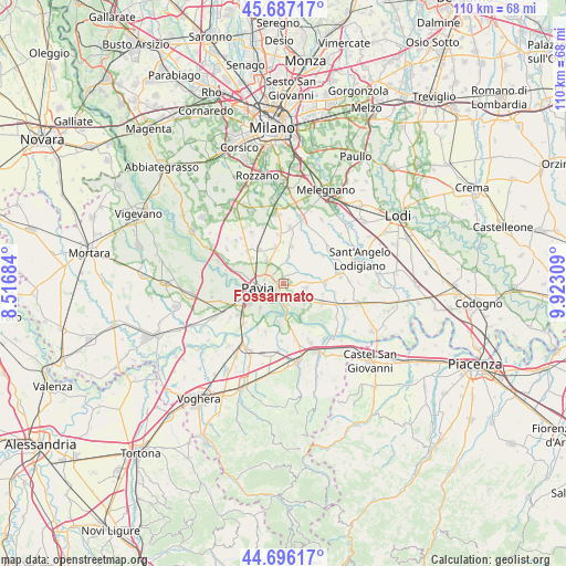
| Upper-left | 45.68717°, | 8.51684° |
| Center: | 45.19383°, | 9.21996° |
| Lower-right: | 44.69617°, | 9.92309° |
| Map W x H: | 110.2×110.2 km | = 68.5×68.5mi |
| max Lat: | 47.04031° ⇑35.2% North |
| Fossarmato: | 45.19383° |
| min Lat: | ⇓64.8% South 35.50142° |
| min Long | Fossarmato | max Long |
| 6.69888° | 9.21996° | 18.48682° |
| W 22.3%⇐ | ⇒77.7% E |
Elevation
Elevation of Fossarmato is 79 m = 259 ft, and this is 227.7 m = 747 ft below average elevation for this country.
| Max E: |
2085 m = 6841 ft | 73.8% |
| Avg. | 306.7 m = 1006 ft | |
| Fossarmato | 79 m = 259 ft | |
Min E: |
-4 m = -13 ft | 26.2% |
See also: Italy elevation on elevation.city.
Geographical zone
Fossarmato is located in North temperate zone (between Tropic of Cancer and the Arctic Circle). Distance of this North polar circle is 2376.1 km =1476.4 mi to North.| Distance of | km | miles | from Fossarmato |
|---|---|---|---|
| North Pole | 4982 | 3095.7 | to North |
| Arctic Circle | 2376.1 | 1476.4 | to North |
| Tropic Cancer | 2419.2 | 1503.2 | to South |
| Equator | 5025.1 | 3122.5 | to South |


Nearby cities:
15 places around Fossarmato: (largest is in red/bold)
• Albuzzano
4.3 km =2.7 mi,  99°
99°
• Calignano
5.3 km =3.3 mi,  66°
66°
• Cura Carpignano
3.5 km =2.2 mi,  53°
53°
• Lardirago
4.8 km =3 mi,  12°
12°
• Linarolo
5.3 km =3.3 mi,  131°
131°
• Pavia
4.8 km =3 mi,  267°
267°
• Roncaro
5.8 km =3.6 mi, 48°
• Rotta
6.8 km =4.2 mi,  239°
239°
• San Genesio ed Uniti
5.5 km =3.4 mi,  325°
325°
• San Martino Siccomario
7.1 km =4.4 mi, 241°
• Sant'Alessio Con Vialone
3.2 km =2 mi, 8°
• Travacò Siccomario
6.9 km =4.3 mi,  223°
223°
• Valle Salimbene
2.7 km =1.7 mi,  154°
154°
• Vigalfo
4.9 km =3 mi,  87°
87°
• Vistarino
7.2 km =4.5 mi, 74°
Sources, notices
• [Note1] Compared only with cities in Italy existing in our database
• [Src1] Map data: © OpenStreetMap contributors (CC-BY-SA)
• [Src2] Other city data from geonames.org with taken over terms of usage.
• [Src3] Geographical zone / Annual Mean Temperature by Robert A. Rohde @ Wikipedia
