Linate geodata
Linate (Lombardy) is a populated place; located in Italy in Europe/Rome (GMT+2) time zone. With population of 1,080 people, there are 6373 cities with bigger population in this country. Compared to other cities in Italy, 71.8% of cities are located further ↓South; 76.9% of cities are located further →East and 68.3% of cities have higher elevation than Linate. Note1
Administrative division(s):
- Level 1: Lombardy
- Level 2: Città metropolitana di Milano
- Level 3: Peschiera Borromeo


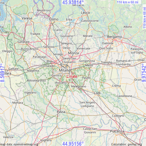
Linate GPS coordinates[2]
45° 26' 49.236" North, 9° 16' 20.244" East
| Map corner | latitude | longitude |
|---|---|---|
| Upper-left | 45.93814°, | 8.56917° |
| Center: | 45.44701°, | 9.27229° |
| Lower-right: | 44.95156°, | 9.97542° |
| Map W x H: | 109.7×109.7 km | = 68.2×68.2mi |
| max Lat: | 47.04031° ⇑28.2% North |
| Linate: | 45.44701° |
| min Lat: | ⇓71.8% South 35.50142° |
| min Long | Linate | max Long |
| 6.69888° | 9.27229° | 18.48682° |
| W 23.1%⇐ | ⇒76.9% E |
Elevation
Elevation of Linate is 107 m = 351 ft, and this is 199.7 m = 655 ft below average elevation for this country.
| Max E: |
2085 m = 6841 ft | 68.3% |
| Avg. | 306.7 m = 1006 ft | |
| Linate | 107 m = 351 ft | |
Min E: |
-4 m = -13 ft | 31.7% |
See also: Italy elevation on elevation.city.
Geographical zone
Linate is located in North temperate zone (between Tropic of Cancer and the Arctic Circle). Distance of this North polar circle is 2347.9 km =1458.9 mi to North.| Distance of | km | miles | from Linate |
|---|---|---|---|
| North Pole | 4953.8 | 3078.1 | to North |
| Arctic Circle | 2347.9 | 1458.9 | to North |
| Tropic Cancer | 2447.3 | 1520.7 | to South |
| Equator | 5053.2 | 3139.9 | to South |


Nearby cities:
15 places around Linate: (largest is in red/bold)
• Bettola-Zeloforomagno
3.4 km =2.1 mi,  122°
122°
• Chiaravalle
4.2 km =2.6 mi,  217°
217°
• Civesio
5.7 km =3.5 mi,  184°
184°
• Mezzate
1.8 km =1.1 mi,  101°
101°
• Millepini
5.7 km =3.5 mi,  63°
63°
• Novegro-Tregarezzo-San Felice
2.4 km =1.5 mi,  16°
16°
• Pantigliate
6.4 km =4 mi, 101°
• Poasco-Sorigherio
5.9 km =3.7 mi,  213°
213°
• Robbiano
4.3 km =2.7 mi,  137°
137°
• San Bovio-San Felice
3.6 km =2.2 mi, 60°
• San Donato Milanese
4.1 km =2.5 mi, 184°
• San Giuliano Milanese
6.1 km =3.8 mi,  166°
166°
• Segrate
5.4 km =3.4 mi, 21°
• Triginto
6.5 km =4 mi, 140°
• Vigliano-Bettolino
5.8 km =3.6 mi,  105°
105°
Sources, notices
• [Note1] Compared only with cities in Italy existing in our database
• [Src1] Map data: © OpenStreetMap contributors (CC-BY-SA)
• [Src2] Other city data from geonames.org with taken over terms of usage.
• [Src3] Geographical zone / Annual Mean Temperature by Robert A. Rohde @ Wikipedia
