Civezzano geodata
Civezzano (Trentino-Alto Adige) is a seat of a third-order administrative division; located in Italy in Europe/Rome (GMT+2) time zone. With population of 1,854 people, there are 4405 cities with bigger population in this country. Compared to other cities in Italy, 94% of cities are located further ↓South; 54.6% of cities are located further →East and 77% of cities have lower elevation than Civezzano. Note1
Administrative division(s):
- Level 1: Trentino-Alto Adige
- Level 2: Provincia autonoma di Trento
- Level 3: Civezzano


Civezzano GPS coordinates[2]
46° 5' 28.788" North, 11° 11' 4.848" East
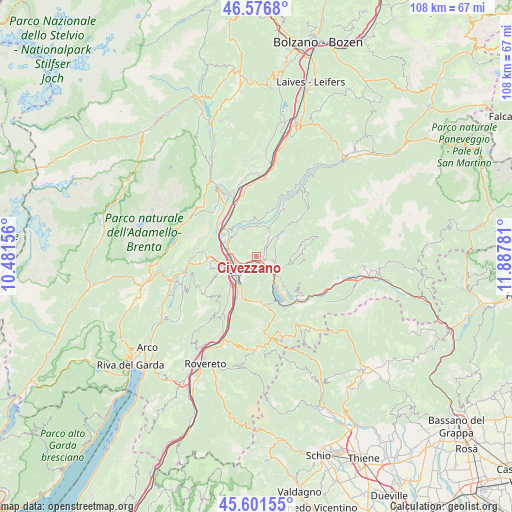
| Map corner | latitude | longitude |
|---|---|---|
| Upper-left | 46.5768°, | 10.48156° |
| Center: | 46.09133°, | 11.18468° |
| Lower-right: | 45.60155°, | 11.88781° |
| Map W x H: | 108.4×108.4 km | = 67.4×67.4mi |
| max Lat: | 47.04031° ⇑6% North |
| Civezzano: | 46.09133° |
| min Lat: | ⇓94% South 35.50142° |
| min Long | Civezzano | max Long |
| 6.69888° | 11.18468° | 18.48682° |
| W 45.4%⇐ | ⇒54.6% E |
Elevation
Elevation of Civezzano is 479 m = 1572 ft, and this is 172.3 m = 565 ft above average elevation for this country.
| Max E: |
2085 m = 6841 ft | 23% |
| Civezzano | 479 m 1572 ft | |
| Avg. | 306.7 m = 1006 ft | |
Min E: |
-4 m = -13 ft | 77% |
See also: Italy elevation on elevation.city.
Geographical zone
Civezzano is located in North temperate zone (between Tropic of Cancer and the Arctic Circle). Distance of this North polar circle is 2276.3 km =1414.4 mi to North.| Distance of | km | miles | from Civezzano |
|---|---|---|---|
| North Pole | 4882.2 | 3033.7 | to North |
| Arctic Circle | 2276.3 | 1414.4 | to North |
| Tropic Cancer | 2519 | 1565.2 | to South |
| Equator | 5124.9 | 3184.5 | to South |


Nearby cities:
15 places around Civezzano: (largest is in red/bold)
• Albiano
6 km =3.7 mi,  7°
7°
• Fornace
3.5 km =2.2 mi,  30°
30°
• Gazzadina
6 km =3.7 mi,  314°
314°
• Madrano-Canzolino
2.6 km =1.6 mi,  107°
107°
• Meano
6.4 km =4 mi, 305°
• Miola di Pinè
6.3 km =3.9 mi,  51°
51°
• Pergine Valsugana
5.1 km =3.2 mi,  126°
126°
• Povo
3.5 km =2.2 mi,  220°
220°
• Seregnano
1 km =0.6 mi,  94°
94°
• Susà
5.3 km =3.3 mi,  148°
148°
• Tavernaro
2.4 km =1.5 mi,  246°
246°
• Trento
5.6 km =3.5 mi,  241°
241°
• Vela
6.4 km =4 mi,  261°
261°
• Vigo Meano
6.1 km =3.8 mi,  320°
320°
• Villamontagna
2 km =1.2 mi, 254°
Sources, notices
• [Note1] Compared only with cities in Italy existing in our database
• [Src1] Map data: © OpenStreetMap contributors (CC-BY-SA)
• [Src2] Other city data from geonames.org with taken over terms of usage.
• [Src3] Geographical zone / Annual Mean Temperature by Robert A. Rohde @ Wikipedia
