Sandetole geodata
Sandetole (Tuscany) is a populated place; located in Italy in Europe/Rome (GMT+2) time zone. With population of 760 people, there are 7881 cities with bigger population in this country. Compared to other cities in Italy, 56.1% of cities are located further ↑North; 50.2% of cities are located further →East and 62.5% of cities have higher elevation than Sandetole. Note1


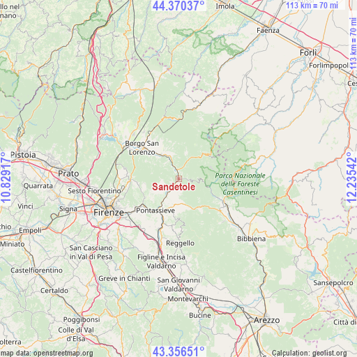
Sandetole GPS coordinates[2]
43° 51' 56.16" North, 11° 31' 56.244" East
| Map corner | latitude | longitude |
|---|---|---|
| Upper-left | 44.37037°, | 10.82917° |
| Center: | 43.8656°, | 11.53229° |
| Lower-right: | 43.35651°, | 12.23542° |
| Map W x H: | 112.7×112.7 km | = 70×70mi |
| max Lat: | 47.04031° ⇑56.1% North |
| Sandetole: | 43.8656° |
| min Lat: | ⇓43.9% South 35.50142° |
| min Long | Sandetole | max Long |
| 6.69888° | 11.53229° | 18.48682° |
| W 49.8%⇐ | ⇒50.2% E |
Elevation
Elevation of Sandetole is 145 m = 476 ft, and this is 161.7 m = 531 ft below average elevation for this country.
| Max E: |
2085 m = 6841 ft | 62.5% |
| Avg. | 306.7 m = 1006 ft | |
| Sandetole | 145 m = 476 ft | |
Min E: |
-4 m = -13 ft | 37.5% |
See also: Italy elevation on elevation.city.
Geographical zone
Sandetole is located in North temperate zone (between Tropic of Cancer and the Arctic Circle). Distance of this Northern Tropic circle is 2271.5 km =1411.4 mi to South.| Distance of | km | miles | from Sandetole |
|---|---|---|---|
| North Pole | 5129.7 | 3187.4 | to North |
| Arctic Circle | 2523.8 | 1568.2 | to North |
| Tropic Cancer | 2271.5 | 1411.4 | to South |
| Equator | 4877.4 | 3030.7 | to South |


Nearby cities:
15 places around Sandetole: (largest is in red/bold)
• Diacceto
9.4 km =5.8 mi,  194°
194°
• Dicomano
3.1 km =1.9 mi,  344°
344°
• I filipponi
2.1 km =1.3 mi,  90°
90°
• Londa
2.6 km =1.6 mi,  95°
95°
• Molino del Piano
12.2 km =7.6 mi,  240°
240°
• Montebonello
5.4 km =3.4 mi,  223°
223°
• Pelago
10.6 km =6.6 mi, 193°
• Pontassieve
13 km =8.1 mi, 218°
• Rabatta
12.9 km =8 mi,  312°
312°
• Rufina
5.9 km =3.7 mi, 218°
• San Francesco
12.1 km =7.5 mi,  213°
213°
• San Godenzo
9.6 km =6 mi,  46°
46°
• Santa Brigida
10.9 km =6.8 mi,  261°
261°
• Tosi
13 km =8.1 mi,  180°
180°
• Vicchio
9.6 km =6 mi,  322°
322°
Sources, notices
• [Note1] Compared only with cities in Italy existing in our database
• [Src1] Map data: © OpenStreetMap contributors (CC-BY-SA)
• [Src2] Other city data from geonames.org with taken over terms of usage.
• [Src3] Geographical zone / Annual Mean Temperature by Robert A. Rohde @ Wikipedia
