Ficarazzelli-Bagni Italia geodata
Ficarazzelli-Bagni Italia (Sicily) is a populated place; located in Italy in Europe/Rome (GMT+2) time zone. With population of 757 people, there are 7901 cities with bigger population in this country. Compared to other cities in Italy, 95.8% of cities are located further ↑North; 73% of cities are located further ←West and 86.1% of cities have higher elevation than Ficarazzelli-Bagni Italia. Note1
Current local time in Ficarazzelli-Bagni Italia:
08:04 PM, WednesdayDifference from your time zone: hours


Ficarazzelli-Bagni Italia GPS coordinates[2]
38° 5' 11.004" North, 13° 26' 53.196" East
| Map corner | latitude | longitude |
|---|---|---|
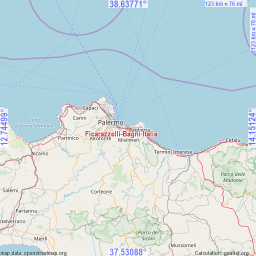
| Upper-left | 38.63771°, | 12.74499° |
| Center: | 38.08639°, | 13.44811° |
| Lower-right: | 37.53088°, | 14.15124° |
| Map W x H: | 123.1×123.1 km | = 76.5×76.5mi |
| max Lat: | 47.04031° ⇑95.8% North |
| Ficarazzelli-Bagni Italia: | 38.08639° |
| min Lat: | ⇓4.2% South 35.50142° |
| min Long | Ficarazzelli-Ba | max Long |
| 6.69888° | 13.44811° | 18.48682° |
| W 73%⇐ | ⇒27% E |
Elevation
Elevation of Ficarazzelli-Bagni Italia is 28 m = 92 ft, and this is 278.7 m = 914 ft below average elevation for this country.
| Max E: |
2085 m = 6841 ft | 86.1% |
| Avg. | 306.7 m = 1006 ft | |
| Ficarazzelli-Bagni Italia | 28 m = 92 ft | |
Min E: |
-4 m = -13 ft | 13.9% |
See also: Italy elevation on elevation.city.
Geographical zone
Ficarazzelli-Bagni Italia is located in North temperate zone (between Tropic of Cancer and the Arctic Circle). Distance of this Northern Tropic circle is 1628.9 km =1012.2 mi to South.| Distance of | km | miles | from Ficarazzelli-Bagni Italia |
|---|---|---|---|
| North Pole | 5772.3 | 3586.7 | to North |
| Arctic Circle | 3166.4 | 1967.5 | to North |
| Tropic Cancer | 1628.9 | 1012.2 | to South |
| Equator | 4234.8 | 2631.4 | to South |


Nearby cities:
15 places around Ficarazzelli-Bagni Italia: (largest is in red/bold)
• Altavilla Milicia
10.4 km =6.5 mi,  121°
121°
• Bagheria
5.7 km =3.5 mi,  98°
98°
• Belmonte Mezzagno
6.6 km =4.1 mi,  227°
227°
• Casteldaccia
8.2 km =5.1 mi, 118°
• Ciaculli
3.8 km =2.4 mi,  251°
251°
• Ficarazzi
1.5 km =0.9 mi,  64°
64°
• Misilmeri
6.1 km =3.8 mi,  180°
180°
• Palermo
11.1 km =6.9 mi,  297°
297°
• Piano Maglio-Blandino
12.6 km =7.8 mi,  255°
255°
• Piano Pantaleo
4.9 km =3 mi,  193°
193°
• Portella di Mare
1.9 km =1.2 mi,  140°
140°
• Santa Flavia
7.7 km =4.8 mi,  74°
74°
• Torre Colonna-Sperone
12.7 km =7.9 mi, 119°
• Villa Ciambra
11.6 km =7.2 mi, 256°
• Villabate
1.1 km =0.7 mi,  206°
206°
Sources, notices
• [Note1] Compared only with cities in Italy existing in our database
• [Src1] Map data: © OpenStreetMap contributors (CC-BY-SA)
• [Src2] Other city data from geonames.org with taken over terms of usage.
• [Src3] Geographical zone / Annual Mean Temperature by Robert A. Rohde @ Wikipedia
