San Giacomo di Musestrelle geodata
San Giacomo di Musestrelle (Veneto) is a populated place; located in Italy in Europe/Rome (GMT+2) time zone. With population of 654 people, there are 8612 cities with bigger population in this country. Compared to other cities in Italy, 81.4% of cities are located further ↓South; 60.4% of cities are located further ←West and 91.5% of cities have higher elevation than San Giacomo di Musestrelle. Note1
Current local time in San Giacomo di Musestrelle:
07:58 PM, WednesdayDifference from your time zone: hours


San Giacomo di Musestrelle GPS coordinates[2]
45° 42' 20.052" North, 12° 20' 3.444" East
| Map corner | latitude | longitude |
|---|---|---|
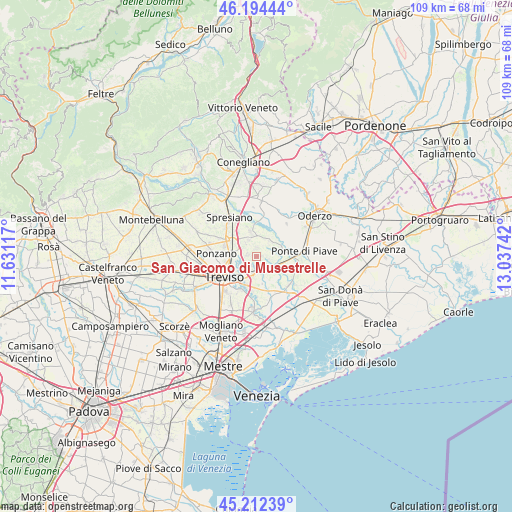
| Upper-left | 46.19444°, | 11.63117° |
| Center: | 45.70557°, | 12.33429° |
| Lower-right: | 45.21239°, | 13.03742° |
| Map W x H: | 109.2×109.2 km | = 67.9×67.9mi |
| max Lat: | 47.04031° ⇑18.6% North |
| San Giacomo di Musestrelle: | 45.70557° |
| min Lat: | ⇓81.4% South 35.50142° |
| min Long | San Giacomo di | max Long |
| 6.69888° | 12.33429° | 18.48682° |
| W 60.4%⇐ | ⇒39.6% E |
Elevation
Elevation of San Giacomo di Musestrelle is 15 m = 49 ft, and this is 291.7 m = 957 ft below average elevation for this country.
| Max E: |
2085 m = 6841 ft | 91.5% |
| Avg. | 306.7 m = 1006 ft | |
| San Giacomo di Musestrelle | 15 m = 49 ft | |
Min E: |
-4 m = -13 ft | 8.5% |
See also: Italy elevation on elevation.city.
Geographical zone
San Giacomo di Musestrelle is located in North temperate zone (between Tropic of Cancer and the Arctic Circle). Distance of this North polar circle is 2319.2 km =1441.1 mi to North.| Distance of | km | miles | from San Giacomo di Musestrelle |
|---|---|---|---|
| North Pole | 4925.1 | 3060.3 | to North |
| Arctic Circle | 2319.2 | 1441.1 | to North |
| Tropic Cancer | 2476.1 | 1538.6 | to South |
| Equator | 5082 | 3157.8 | to South |


Nearby cities:
15 places around San Giacomo di Musestrelle: (largest is in red/bold)
• Breda
1.9 km =1.2 mi,  351°
351°
• Candelù
4.4 km =2.7 mi,  42°
42°
• Carbonera
4.3 km =2.7 mi,  249°
249°
• Cavrie
2.8 km =1.7 mi,  94°
94°
• Lancenigo-Villorba
6.1 km =3.8 mi,  277°
277°
• Maserada sul Piave
5.3 km =3.3 mi, 346°
• Mignagola
2.1 km =1.3 mi,  207°
207°
• Pero
1.1 km =0.7 mi, 85°
• Pezzan
3.4 km =2.1 mi,  255°
255°
• Saletto-San Bartolomeo
5.3 km =3.3 mi,  64°
64°
• San Biagio di Callalta
4.1 km =2.5 mi,  126°
126°
• San Floriano-Olmi
3.6 km =2.2 mi,  184°
184°
• Vacil
2 km =1.2 mi, 283°
• Varago
4 km =2.5 mi,  332°
332°
• Vascon
3.7 km =2.3 mi,  298°
298°
Sources, notices
• [Note1] Compared only with cities in Italy existing in our database
• [Src1] Map data: © OpenStreetMap contributors (CC-BY-SA)
• [Src2] Other city data from geonames.org with taken over terms of usage.
• [Src3] Geographical zone / Annual Mean Temperature by Robert A. Rohde @ Wikipedia
