Saletto-San Bartolomeo geodata
Saletto-San Bartolomeo (Veneto) is a populated place; located in Italy in Europe/Rome (GMT+2) time zone. With population of 1,311 people, there are 5597 cities with bigger population in this country. Compared to other cities in Italy, 82.5% of cities are located further ↓South; 61.2% of cities are located further ←West and 92.6% of cities have higher elevation than Saletto-San Bartolomeo. Note1
Current local time in Saletto-San Bartolomeo:
09:39 PM, WednesdayDifference from your time zone: hours


Saletto-San Bartolomeo GPS coordinates[2]
45° 43' 35.004" North, 12° 23' 44.016" East
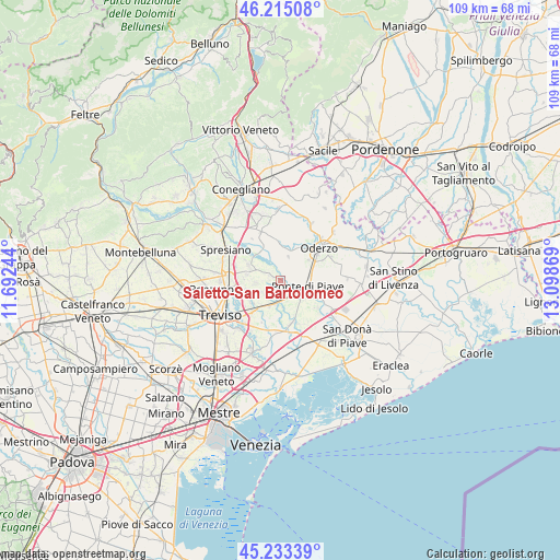
| Map corner | latitude | longitude |
|---|---|---|
| Upper-left | 46.21508°, | 11.69244° |
| Center: | 45.72639°, | 12.39556° |
| Lower-right: | 45.23339°, | 13.09869° |
| Map W x H: | 109.2×109.2 km | = 67.9×67.9mi |
| max Lat: | 47.04031° ⇑17.5% North |
| Saletto-San Bartolomeo: | 45.72639° |
| min Lat: | ⇓82.5% South 35.50142° |
| min Long | Saletto-San Bar | max Long |
| 6.69888° | 12.39556° | 18.48682° |
| W 61.2%⇐ | ⇒38.8% E |
Elevation
Elevation of Saletto-San Bartolomeo is 13 m = 43 ft, and this is 293.7 m = 964 ft below average elevation for this country.
| Max E: |
2085 m = 6841 ft | 92.6% |
| Avg. | 306.7 m = 1006 ft | |
| Saletto-San Bartolomeo | 13 m = 43 ft | |
Min E: |
-4 m = -13 ft | 7.4% |
See also: Italy elevation on elevation.city.
Geographical zone
Saletto-San Bartolomeo is located in North temperate zone (between Tropic of Cancer and the Arctic Circle). Distance of this North polar circle is 2316.9 km =1439.7 mi to North.| Distance of | km | miles | from Saletto-San Bartolomeo |
|---|---|---|---|
| North Pole | 4922.8 | 3058.9 | to North |
| Arctic Circle | 2316.9 | 1439.7 | to North |
| Tropic Cancer | 2478.4 | 1540 | to South |
| Equator | 5084.3 | 3159.2 | to South |


Nearby cities:
15 places around Saletto-San Bartolomeo: (largest is in red/bold)
• Bocca Callalta
4.4 km =2.7 mi,  123°
123°
• Breda
5 km =3.1 mi,  265°
265°
• Candelù
2 km =1.2 mi,  297°
297°
• Cavrie
3.2 km =2 mi,  218°
218°
• Fagarè
3.3 km =2.1 mi,  130°
130°
• Levada
5.9 km =3.7 mi,  81°
81°
• Negrisia
3.2 km =2 mi, 75°
• Ormelle
6.1 km =3.8 mi,  21°
21°
• Pero
4.3 km =2.7 mi,  238°
238°
• Ponte di Piave
5.2 km =3.2 mi,  99°
99°
• Roncadelle
3.7 km =2.3 mi, 18°
• Rovarè
5.3 km =3.3 mi,  172°
172°
• San Biagio di Callalta
5 km =3.1 mi,  196°
196°
• San Giacomo di Musestrelle
5.3 km =3.3 mi, 244°
• Vigonovo di Sopra
6 km =3.7 mi, 100°
Sources, notices
• [Note1] Compared only with cities in Italy existing in our database
• [Src1] Map data: © OpenStreetMap contributors (CC-BY-SA)
• [Src2] Other city data from geonames.org with taken over terms of usage.
• [Src3] Geographical zone / Annual Mean Temperature by Robert A. Rohde @ Wikipedia
