Caviola geodata
Caviola (Veneto) is a populated place; located in Italy in Europe/Rome (GMT+2) time zone. With population of 591 people, there are 9082 cities with bigger population in this country. Compared to other cities in Italy, 97.4% of cities are located further ↓South; 54.5% of cities are located further ←West and 98% of cities have lower elevation than Caviola. Note1


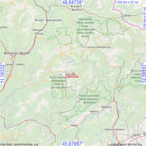
Caviola GPS coordinates[2]
46° 21' 51.588" North, 11° 53' 47.184" East
| Map corner | latitude | longitude |
|---|---|---|
| Upper-left | 46.84738°, | 11.19332° |
| Center: | 46.36433°, | 11.89644° |
| Lower-right: | 45.87697°, | 12.59957° |
| Map W x H: | 107.9×107.9 km | = 67×67mi |
| max Lat: | 47.04031° ⇑2.6% North |
| Caviola: | 46.36433° |
| min Lat: | ⇓97.4% South 35.50142° |
| min Long | Caviola | max Long |
| 6.69888° | 11.89644° | 18.48682° |
| W 54.5%⇐ | ⇒45.5% E |
Elevation
Elevation of Caviola is 1092 m = 3583 ft, and this is 785.3 m = 2576 ft above average elevation for this country.
| Max E: |
2085 m = 6841 ft | 2% |
| Caviola | 1092 m 3583 ft | |
| Avg. | 306.7 m = 1006 ft | |
Min E: |
-4 m = -13 ft | 98% |
See also: Italy elevation on elevation.city.
Geographical zone
Caviola is located in North temperate zone (between Tropic of Cancer and the Arctic Circle). Distance of this North polar circle is 2245.9 km =1395.5 mi to North.| Distance of | km | miles | from Caviola |
|---|---|---|---|
| North Pole | 4851.8 | 3014.8 | to North |
| Arctic Circle | 2245.9 | 1395.5 | to North |
| Tropic Cancer | 2549.3 | 1584.1 | to South |
| Equator | 5155.2 | 3203.3 | to South |


Nearby cities:
15 places around Caviola: (largest is in red/bold)
• Alba-Penia
12.9 km =8 mi,  323°
323°
• Alleghe
10.8 km =6.7 mi,  63°
63°
• Canale d'Agordo
1.6 km =1 mi,  120°
120°
• Celat-San Tomaso Agordino
6.3 km =3.9 mi,  73°
73°
• Cencenighe Agordino
5.7 km =3.5 mi,  104°
104°
• Colle Santa Lucia
13 km =8.1 mi,  43°
43°
• Falcade Alto
3.2 km =2 mi,  251°
251°
• Livinallongo del Col di Lana
13.8 km =8.6 mi,  18°
18°
• Pie' Falcade
2.1 km =1.3 mi, 245°
• Rocca Pietore
9.9 km =6.2 mi, 38°
• Sachet
2.7 km =1.7 mi,  77°
77°
• Taibon Agordino
11.6 km =7.2 mi,  129°
129°
• Vallada Agordina
2.9 km =1.8 mi,  89°
89°
• Voltago
13.2 km =8.2 mi,  140°
140°
• Voltago Agordino
13.3 km =8.3 mi, 140°
Sources, notices
• [Note1] Compared only with cities in Italy existing in our database
• [Src1] Map data: © OpenStreetMap contributors (CC-BY-SA)
• [Src2] Other city data from geonames.org with taken over terms of usage.
• [Src3] Geographical zone / Annual Mean Temperature by Robert A. Rohde @ Wikipedia
